Región de Ñuble
| Ñuble XVI. Region of the
Ñuble region |
|||
|---|---|---|---|
| Symbols | |||
|
|||
| Basic data | |||
| Country | Chile | ||
| Capital | Chillan | ||
| surface | 13,178.5 km² | ||
| Residents | 480,609 (2017 census) | ||
| density | 36 inhabitants per km² | ||
| ISO 3166-2 | CL-NB | ||
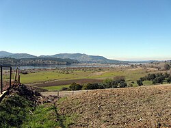
| Itata river | |||
Coordinates: 36 ° 36 ′ S , 72 ° 6 ′ W
The Región de Ñuble forms the XVI. Region of Chile . The capital of the region is Chillán . The new region was established on September 6, 2018 at 0:00 a.m. local time (5:00 a.m. CEST ) and emerged from the previous province of the same name, Ñuble , which belonged to Region VIII ( Región del Bío-Bío ). It has 480,609 inhabitants (2017 census) on an area of 13,178.5 km².
Provinces
The region, whose territory previously consisted of only one province, is divided into the three newly created provinces, Itata , Diguillín and Punilla .
| Political-administrative division of the Ñuble region | |||||||||||||||||||||||||||||||
|---|---|---|---|---|---|---|---|---|---|---|---|---|---|---|---|---|---|---|---|---|---|---|---|---|---|---|---|---|---|---|---|
|

|
||||||||||||||||||||||||||||||
Web links
Commons : Región de Ñuble - collection of images, videos and audio files


