
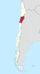
Atacama region
| Atacama Region III
Región de Atacama |
|||
|---|---|---|---|
  |
|||
| Symbols | |||
|
|||
| Basic data | |||
| Country | Chile | ||
| Capital | Copiapó | ||
| surface | 75,176.2 km² | ||
| Residents | 286,168 (2017 census) | ||
| density | 3.8 inhabitants per km² | ||
| ISO 3166-2 | CL-AT | ||
| Website | www.goreatacama.cl | ||
| politics | |||
| Intendant | Miguel Vargas Correa | ||
 |
|||


Coordinates: 27 ° 18 ′ S , 70 ° 17 ′ W
The Región de Atacama forms Region III within Chile (South America). It is located in the Atacama Desert region and is relatively sparsely populated.
geography
The main cities are:
- Copiapó , 129,281 inhabitants (2005)
- Vallenar , 48,000 inhabitants (2003)
- Caldera , 14,000 inhabitants (2003)
- Chañaral , 12,500 inhabitants (2003)
Region III has several national parks and other nature reserves:
- Nevado Tres Cruces National Park in the northeastern region in the Andes -region
- Llanos de Challe National Park north of Vallenar
- Pan de Azúcar National Park on the northern border of the region
- Reserva Nacional Pingüino de Humboldt in the south on the Pacific coast
The region has the highest mountains in Chile, the Ojos del Salado (6893 m), Cerro Tres Cruces (6753 m) and the Incahuasi (6621 m). The highest point in Chile is the extinct volcano Ojos del Salado . It is located in the Nevado Tres Cruces National Park.
history
Despite its lack of water, the Atacama was settled early on. The Atacameños , Aymara , Chinchorros and Diaguitas peoples lived around the sparse oases .
Then the area became part of the Inca Empire . In 1536, conquistador Diego de Almagro was the first to reach the area around Copiapó . After the fall of the Inca rule, the desert came under Spanish rule. The independence efforts of the South American states let the Atacama fall to Bolivia.
In 1832 a large silver deposit was discovered in Chañarcillo (50 km south of Copiapó ) , which made Chile one of the largest silver producers in the world for decades. In 1916 the exploitation of the copper deposits at Potrerillos began .
After the saltpeter war (1879-1884), which was waged over the rich nitrate deposits in the desert and which Chile won against Peru and Bolivia with British encouragement and help, Chile was able to expand its territory considerably to the north at the expense of Peru and Bolivia. The loss of access to the Pacific Ocean is still a major diplomatic point of conflict between Chile and Bolivia. Until the Saltpeter War, today's Región de Atacama was the northernmost province of Chile.
Provinces
| province | Capital | Municipalities |

|
|---|---|---|---|
| Chañaral | Chañaral | 1 Chañaral | |
| 2 Diego de Almagro | |||
| Copiapó | Copiapó | 3 caldera | |
| 4 Copiapó | |||
| 5 Tierra Amarilla | |||
| Huasco | Vallenar | 6 Alto del Carmen | |
| 7 Freirina | |||
| 8 Huasco | |||
| 9 Vallenar |
Infrastructure
The region is opened up for air traffic through the Aeropuerto Desierto de Atacama near Caldera.
Web links
I. Región de Tarapacá | II. Región de Antofagasta | III. Atacama Region | IV. Región de Coquimbo | V. Región de Valparaíso | VI. Región del Libertador General Bernardo O'Higgins | VII. Región del Maule | VIII. Región del Biobío | IX. Región de la Araucanía | X. Región de los Lagos | XI. Región de Aysén del General Carlos Ibáñez del Campo | XII. Región de Magallanes y de la Antártica Chilena | XIV. Región de Los Ríos | XV. Región de Arica y Parinacota | XVI. Región de Ñuble | Metropolitan Region of Santiago