Reimboldshausen (sand)
Coordinates: 51 ° 15 ′ 33 " N , 9 ° 16 ′ 42" E
Reimboldshausen was a small village settlement that had fallen into desolation in the 14th century in what is now the district of Sand , a district of the Bad Emstal community in the northern Hessian district of Kassel .
Geographical location
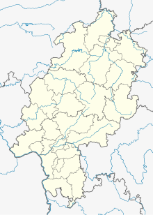
The place was located south of Martinhagen and northwest of the Falkenstein castle ruins in the valley of the Ems , or in the so-called Reimershäuser Graben near its confluence with the Ems. Today only the names of the Remmenhausener Kopf (427.6 m above sea level) to the west of the Ems and the local forest area "Remmenhausen" remind of the disappeared settlement, the name of which appears in variously modified forms in old documents: Reinboldeshusen, Reinboldishusen (1233) , Reymboldeshusen (1311), Renboldehusen (1359), Reinboldessen (15th century), Remenhausen (1541), Reimelshausen (1579), Reinboldshausen (1857), field name Remmenhausen.
The state road L 3220 from Sand to Breitenbach leads past the desert not far to the west.
history
Very little is known about the history of the settlement, and it may have been just a single farm. In 1233 the knight Hermann Hund from Holzhausen (Hahn) , the last of this branch of the dog, determined that after his death the villa Reinboldishusen should go to the Merxhausen Monastery , founded in 1213 , and in 1236 he transferred this property to the monastery in return for a life annuity from. In 1311 freed Mainz Archbishop Peter von Aspelt the Hob Reymboldeshusen the monastery from all burdens. With Sand, Riede and Merxhausen , Reinboldeshusen also belonged to the Balhorn court established in 1340 by Landgrave Heinrich II . The place was already desolate by 1359 at the latest.
The extensive forest area "Remmenhausen" on and around the Remmenhausen head came into its possession soon after the Merxhausen Monastery was founded, and this remained after the monastery was dissolved in 1527 and converted into a Hohes Hospital in 1533 . This forest area is now managed by the Fischbach / Merxhausen district forester of the Haina Monastery Forest Foundation.
Footnotes
- ^ Georg Landau : Historical-topographical description of the desolate places in the Electorate of Hesse ..., (Journal of the Association for Hessian History and Regional Studies; Seventh Supplement). Fischer, Kassel, 1858, p. 157
- ^ Georg Landau : Description of the Hessengau. (Description of the German Gaue, Volume Two.) Döll and Schäffer, Kassel, 1857, p. 218
- ^ Friedrich Bleibaum (ed.): The architectural and art monuments in the Kassel administrative region; New episode, first volume: Wolfhagen district. Bärenreiter-Verlag, Kassel, 1937, p. 250
- ^ Georg Landau : Historical-topographical description of the desolate places in the Electorate of Hesse ..., (Journal of the Association for Hessian History and Regional Studies; Seventh Supplement). Fischer, Kassel, 1858, p. 157
- ^ Balhorn, Kassel district. Historical local dictionary for Hessen. In: Landesgeschichtliches Informationssystem Hessen (LAGIS).
- ^ Friedrich Bleibaum (ed.): The architectural and art monuments in the Kassel administrative region; New episode, first volume: Wolfhagen district. Bärenreiter-Verlag, Kassel, 1937, p. 250
- ^ Heinrich Boucsein: The forests of the high hospitals Haina and Merxhausen in the 16th century , in: W. Heinemeyer & T. Pünder (eds.): 450 years of psychiatry in Hessen . Elwert, Marburg, 1983, pp 185-210 (205)
