Revillagigedo Island
| Revillagigedo Island | ||
|---|---|---|
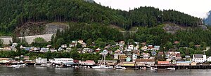
| View of Ketchikan | ||
| Waters | Pacific Ocean | |
| Archipelago | Alexander Archipelago | |
| Geographical location | 55 ° 35 ′ N , 131 ° 22 ′ W | |
|
|
||
| length | 89 km | |
| width | 48 km | |
| surface | 2 754 km² | |
| Highest elevation |
Mount Reid 1400 m |
|
| Residents | 13,950 (2000) 5.1 inhabitants / km² |
|
| main place | Ketchikan | |
| Map sheet with Revillagigedo Island | ||
Revillagigedo Island is an island in southeast Alaska ( Panhandle ) of the Alexander Archipelago in the Pacific Ocean . The island is about 2754 km², 89 km long and up to 48 km wide. Administratively it belongs to the Ketchikan Gateway Borough . The highest point is Mount Reid, 1400 m high, in the uninhabited northeast of the island.
It is separated from the Prince of Wales Island in the west by Clarence Strait and from mainland Alaska by the Behm Canal in the east. At the southern tip between Revillagigedo and Anette Island are the Revillagigedo Channel and the Nichols Passage .
The island was discovered by Russian, British and Spanish sailors in the 18th century and was later named after Juan Vicente de Güemes Pacheco y Padilla, Conde de Revillagigedo II , the 53rd Viceroy of New Spain .
About 13,950 people live on the island, mainly in the towns of Ketchikan and Saxman and in Ward Cove on the southwest coast. The inhabitants live mainly from fishing , logging and tourism .
Web links
- Revillagigedo Island in the United States Geological Survey's Geographic Names Information System
- Topographic map (PDF; 173 kB)
Individual evidence
- ↑ Mount Reid at Peakbagger.com (English)


