Ribnica na Pohorju
|
Ribnica na Pohorju Reifnig am Bachern |
|||
|
|||
| Basic data | |||
|---|---|---|---|
| Country |
|
||
| Historic region | Lower Styria / Štajerska | ||
| Statistical region | Koroška (Slovenian Carinthia) | ||
| Coordinates | 46 ° 32 ' N , 15 ° 16' E | ||
| height | 715 m. i. J. | ||
| surface | 59.3 km² | ||
| Residents | 1,180 (January 1, 2016) | ||
| Population density | 20 inhabitants per km² | ||
| Post Code | 2364 | ||
| License Plate | SG | ||
| Structure and administration | |||
| Mayor : | Srečko Geč | ||
| Mailing address | Ribnica na Pohorju 1 2364 Ribnica na Pohorju |
||
| Website | |||
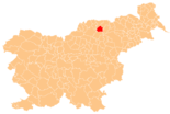
Ribnica na Pohorju ( German : Reifnig am Bachern ) is a former Styrian municipality that is now part of the Koroška region in Slovenia .
geography
Ribnica na Pohorju is located between the valley and the Velka Vuhreščica Valley entirely in Pohorje ( Pohorje ). The community is located away from major traffic routes, the next nationally significant road is the national road 1 "Marburger Straße" in the Drautal, which can be reached via a regional road to Podvelka or to Vuhred . The next larger cities are Slovenj Gradec in about 15 km as the crow flies and Maribor in about 30 km. There are connections to the railway network in Vuhred and Podvelka, each around 10 km away.
The highest point in the municipality is at 1541 m. i. J. the "Velika Kopa" in the southeastern municipality.
Community structure
The municipality comprises six localities. The German exonyms in brackets date from the middle of the 19th century and are no longer used today. (Population figures as of January 1, 2016):
|
|
Neighboring communities
| Radlje ob Dravi | Podvelka | |
| Vuzenica |

|
|
| Slovenj Gradec | Mislinja | Lovrenc na Pohorju |
history
In Roman times, the road from Slovenske Konjice into the Drau valley ran through Ribnica . Today the place is a well-known skiing and hiking area.
Attractions
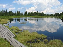
The legendary Lake Ribnica (Ribniško jezero) lies on the summit of Plešivec at an altitude of 1490 m . This raised bog is only filled with rainwater.
Web links
- Website of the municipality in Slovenian
- Information about Radlje ob Dravi
- Map of the municipality of Ribnica na Pohorju
Individual evidence
- ↑ REIFNIGG, Styria in 1900's.
- ^ General state law and government gazette for the Crown Land of Styria. 1850 (supplement Marburg district)
- ↑ Statistical Office of the Republic of Slovenia ( English )
- ↑ Legend of Ribniško jezero
- ^ Ribniško jezero


