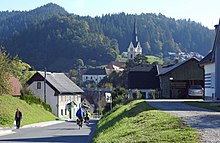
Vuzenica
|
Vuzenica Saldenhofen |
|||
|
|||
| Basic data | |||
|---|---|---|---|
| Country |
|
||
| Historic region | Lower Styria / Štajerska | ||
| Statistical region | Koroška (Slovenian Carinthia) | ||
| Coordinates | 46 ° 36 ' N , 15 ° 10' E | ||
| height | 338 m. i. J. | ||
| surface | 50.1 km² | ||
| Residents | 2,670 (January 1, 2017) | ||
| Population density | 53 inhabitants per km² | ||
| Telephone code | (+386) 02 | ||
| Post Code | 2367 | ||
| License Plate | SG | ||
| Structure and administration (as of 2017) | |||
| Community type | local community | ||
| Mayor : | Franc Franjo Golob | ||
| Mailing address | Mladinska ulica 1 2367 Vuzenica |
||
| Website | |||
Vuzenica ( German : Saldenhofen ) is a town and municipality in Slovenia . It is located in the historical Spodnja Štajerska ( Lower Styria ) region, but now belongs to the statistical region of Koroška ( Carinthia ).
geography
location
Vuzenica lies on the Drava ( Drava ) at the confluence with the Crkvenica ( Kirchbach ), south of Muta . A large part of the municipality belongs to the Pohorje ( Bachern Mountains ).
Community structure
The municipality comprises five localities. The German exonyms in brackets were mainly used by the German-speaking population until the area was ceded to the Kingdom of Serbs, Croats and Slovenes in 1918 and are largely uncommon today. (Population figures as of January 1, 2017):
- Dravče ( Drautsch ), 136
- Sveti Primož na Pohorju ( Sankt Primon am Bachern ), 316
- Sveti Vid ( Sankt Veit ), 435
- Šentjanž nad Dravčami ( Sankt Johann ob Drautsch ), 251
- Vuzenica ( Saldenhofen ), 1.532
Neighboring communities
| Dravograd | Muta | Radlje ob Dravi |
| Dravograd |

|
Radlje ob Dravi |
| Slovenj Gradec | Slovenj Gradec | Ribnica na Pohorju |
history
The village was first mentioned in 1238 and is one of the oldest settlements in the valley. It was mentioned as a market as early as 1288. The rafting gave the place an additional boost. The church of Sv. Nikolaj (Saint Nicholas) and the rectory. There, all the names of the pastors are entered on a board. Also that of the later first bishop of the Archdiocese of Maribor , Anton Martin Slomšek .
Web links
Individual evidence
- ↑ Location of the place
- ↑ Special map of the Austro-Hungarian Monarchy 1: 75,000 - Unterdrauburg 5354. (1914)
- ↑ Population tables of the Statistical Office of the Republic of Slovenia ( Slovene )
- ^ History
Saldenhofen (top center) around 1877 (recording sheet of the state survey )


