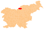
Črna na Koroškem
|
Črna na Koroškem Schwarzenbach |
|||
|
|||
| Basic data | |||
|---|---|---|---|
| Country |
|
||
| Historic region | Lower Carinthia | ||
| Statistical region | Koroška (Slovenian Carinthia) | ||
| Coordinates | 46 ° 28 ' N , 15 ° 51' E | ||
| height | 574 m. i. J. | ||
| surface | 156 km² | ||
| Residents | 3,308 (January 1, 2017) | ||
| Population density | 21 inhabitants per km² | ||
| Post Code | 2393 | ||
| License Plate | SG | ||
| Structure and administration | |||
| Mayor : | Romana Lesjak | ||
| Mailing address | Center 101 2393 Črna na Koroškem |
||
| Website | |||
Črna na Koroškem ( German Schwarzenbach ) is a village and municipality in Slovenia . It is located in the historical Koroška ( Lower Carinthia ) region and in the statistical region of the same name .
geography
location
Črna na Koroškem is located in the Karawanken ( Karavanke ) in the upper Mežatal ( Mieß ) and is considered one of the most beautiful villages in the valley. The main town of Črna, located roughly in the center of the municipality, is at 574 m. ü. A. , the highest point is at 2125 m. ü. A. the Kordeschkopf ( Kordeževa Glava ), the peak of Peca ( Peca ) directly on the border with Austria .
The settlement in the municipality is largely based on the numerous valleys and their rivers and streams. The main river Meža flows from the west through the place Črna further north. On the left side tributaries are the Topla ( Toplabach ) and the Helenksi potok ( Mallingbach ), on the right side the Bistra ( Wistrabach ), the Javorski potok ( Javoria ) and the Jasbinski potok ( Jasvina ) unite with their main river.
There are significant road connections along the lower Meža valley to Ravne na Koroškem and through the Javorski potok valley over the Sleme pass to Šoštanj . You can also get to Solčava via a gravel road and the pass, also known as Sleme (in German : Wistrasattel ) .
Community structure
The municipality comprises nine localities. The German exonyms in brackets were mainly used by the German-speaking population until the area was ceded to the Kingdom of Serbs, Croats and Slovenes in 1918 and are largely uncommon today. (Population figures as of January 1, 2017):
|
|
Neighboring communities
| Eisenkappel-Vellach ( A ) |
Feistritz ob Bleiburg ( A ), Mežica |
Prevalje , Ravne na Koroškem |
| Eisenkappel-Vellach ( A ) |

|
Slovenj Gradec |
| Solčava | Luče , Ljubno | Šoštanj |
history
The church of Črna was first mentioned in 1137 as a branch church of St. Michael ob Bleiburg . In 1616 the village became an independent parish. Mining began in this region around 1665. The lead and zinc mine is one of the oldest of its kind in the Alpine region. The tunnels reach a length of almost 1000 km. The place belonged to the Duchy of Carinthia until 1918 (hence the Slovenian name Carinthia in the name) in Austria-Hungary , then to the SHS state (Yugoslavia). Since 1991 it has been part of the independent Slovenia.
Since 2013 there has been a partnership with the Croatian island and municipality of Šolta .
economy
Cognitively handicapped residents of the community commute to work and supervised work every day in the delavnica Florijan in neighboring Globasnitz in Austria .
Worth seeing
The Najevska lipa , an almost 800-year-old linden tree, is remarkable . The imposing size and history make this tree a national monument.
Personalities
- Carl von Scheuchenstuel (1792–1867), Austrian mountain official
- Tina Maze (* 1983), Slovenian ski racer
Web links
- Website of the municipality Slovene
- Information about the community
- Map of the municipality of Črna na Koroškem
Individual evidence
- ↑ Special map of the Austro-Hungarian Monarchy 1: 75,000 - Prassberg ad Sann 5454. (1915)
- ^ Special map of the Austro-Hungarian Monarchy 1: 75,000 - Eisenkappel and Kanker 5453. (1918)
- ↑ Population tables of the Statistical Office of the Republic of Slovenia ( Slovene )
- ↑ Mining ( Memento from January 25, 2013 in the web archive archive.today )
- ↑ Općina Šolta: Bratimljeni gradovi i Opčine - Črna na Koroškem (Republika Slovenija). September 25, 2018, accessed August 17, 2019 (Croatian).
- ^ Lindenbaum ( Memento from May 20, 2008 in the Internet Archive )


