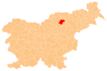
Mislinja
|
Mislinja Missling |
|||
|
|||
| Basic data | |||
|---|---|---|---|
| Country |
|
||
| Historic region | Lower Styria / Štajerska | ||
| Statistical region | Koroška (Slovenian Carinthia) | ||
| Coordinates | 46 ° 27 ' N , 15 ° 12' E | ||
| height | 598 m. i. J. | ||
| surface | 112.2 km² | ||
| Residents | 4,561 (January 1, 2017) | ||
| Population density | 41 inhabitants per km² | ||
| Post Code | 2382 | ||
| License Plate | SG | ||
| Structure and administration | |||
| Mayor : | Bojan Borovnik | ||
| Mailing address | Šolska cesta 34 2382 Mislinja |
||
| Website | |||
Mislinja ( German : Missling ) is a town and municipality in Slovenia . It lies in the historical Spodnja Štajerska ( Lower Styria ) region, but is now part of the statistical region of Koroška ( Lower Carinthia ).
geography
location
Mislinja is located in the upper Mislinja valley ( Missling ) at the intersection of the Pohorje ( Bachern Mountains ) and the Karawanken ( Karavanke ) between the municipalities of Velenje and Slovenj Gradec . It is also the southernmost municipality in the Koroška region. The village of Mislinja is at 598 m. ü. A. , in the north of the municipality is the Črni vrh ( Schwarzkogel ), at 1543 m the highest mountain in Pohorje and the highest elevation in the municipality.
Community structure
The municipality comprises eleven localities. The German exonyms in brackets were mainly used by the German-speaking population until the area was ceded to the Kingdom of Serbs, Croats and Slovenes in 1918 and are largely uncommon today. (Population figures as of January 1, 2017):
|
|
1 Paka only partially belongs to the Mislinja municipality, the Vitanje municipality includes another part.
Neighboring communities
| Slovenj Gradec | Ribnica na Pohorju | Lovrenc na Pohorju |
| Slovenj Gradec |

|
Zreče |
| Velenje | Dobrna | Vitanje |
history
The place is mentioned for the first time in 1404 and originally belonged to the Duchy of Steyer (Styria). Thanks to the hammer mills , the boom began. In 1724 the first plants were already in operation. In the middle of the 19th century, this branch of the economy increasingly lost its importance. Forestry began around 1900. A cardboard lid factory, a barrel workshop, some sawmills and also a power station for self-consumption were built. A 9.4 km long narrow-gauge railway to Mislinjski jarek was also built. At that time it was the only such forest railway in Central Europe. It was in operation until 1956.
Attractions
- One of the three most modern Slovenian ski jumping centers is located in Mislinja.
- Štrekna : bike path on an abandoned section of the Lavant Valley Railway
Web links
- Website of the municipality (Slovenian)
- Information on the municipality of Mislinja , arnes.si
- Map of the municipality of Mislinja
Individual evidence
- ↑ Special map of the Austro-Hungarian Monarchy 1: 75,000 - Prassberg ad Sann 5454. (1915)
- ↑ Population tables of the Statistical Office of the Republic of Slovenia ( Slovene )
- ↑ Hammerwerk ( Memento of the original from May 21, 2008 in the Internet Archive ) Info: The archive link has been inserted automatically and has not yet been checked. Please check the original and archive link according to the instructions and then remove this notice. , koroska.si
- ↑ Ski jumping center ( Memento of the original from May 23, 2008 in the Internet Archive ) Info: The archive link has been inserted automatically and has not yet been checked. Please check the original and archive link according to the instructions and then remove this notice. , koroska.si


