Richmond River
| Richmond River | ||
|
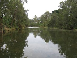
Richmond River in Casino (2006) |
||
| Data | ||
| location | New South Wales , Australia | |
| River system | Richmond River | |
| source | Mount Lindesay at Dairy Flat 28 ° 22 ′ 31 ″ S , 152 ° 42 ′ 26 ″ E |
|
| Source height | 236 m | |
| muzzle |
Tasman Sea in Ballina Coordinates: 28 ° 52 ′ 35 " S , 153 ° 35 ′ 27" E 28 ° 52 ′ 35 " S , 153 ° 35 ′ 27" E |
|
| Mouth height | 0 m | |
| Height difference | 236 m | |
| Bottom slope | 0.95 ‰ | |
| length | 248 km | |
| Catchment area | 6850 km² | |
| Left tributaries | Findon Creek, Gradys Creek, Lynchs Creek, Fawcetts Creek, Wilsons River , Emigrant Creek | |
| Right tributaries | Back Creek, Rosebery Creek, Horse Station Creek, Eden Creek, Shannon Brook, Bungawalbin Creek | |
| Medium-sized cities | Kyogle , Casino , Ballina | |
| Communities | Grenvilla, Old Grenvilla, The Risk, Wiangaree, Cedar Point, Fairy Hill, Tatham, Coraki, Woodburn, Broadwater, Wardell, Empire Vale | |
|
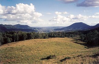
Lynchs Creek, one of the many tributaries of the Richmond River in the valleys north of Kyogle (1994) |
||
The Richmond River is a river in the extreme northeast of the Australian state of New South Wales .
geography
The river has its source on the southern slopes of Mount Lindesay in the foothills of the Border Ranges and initially flows southeast to north of Wiangaree . He turns south and passes through Kyogle to Casino . There it turns again to the southeast to Woodburn , about ten kilometers west of the coast. From there it flows, now parallel to the coast, to the northeast and flows into the Tasman Sea , a marginal sea of the Pacific , in Ballina .
Its catchment area is 6,850 km², making it the sixth largest in New South Wales. Its flood plain is over 1000 km². Together with the Clarence River in the south and the Tweed River in the north, the Richmond River forms the Northern Rivers , a district in New South Wales.
Tributaries with mouth heights
- Back Creek - 213 m
- Findon Creek - 109 m
- Rosebery Creek - 97 m
- Gradys Creek - 80 m
- Lynchs Creek - 73 m
- Fawcetts Creek - 53 m
- Horse Station Creek - 46 m
- Eden Creek - 27 m
- Shannon Brook - 5 m
- Wilsons River - 4 m
- Bungawalbin Creek - 3 m
- Emigrant Creek - 0 m
history
Captain James Cook overlooked the river on his voyage up the east coast of Australia in 1770. It was not until 1828 that Captain Henry John Rous became the first European to discover the estuary. He drove up the river about 20 miles and named it after Charles Gordon-Lennox, 5th Duke of Richmond . The botanist Allan Cunningham later reached the river by land.
From the 1840s until well into the 20th century, the lower reaches of the Richmond River served as an important anchorage. The first settlers in the area soon recognized the huge stocks of red cedar ( Toona ciliata ) in the river valley and immediately began logging. The river played an important role as a transport route for the wood.
When it was discovered in 1828 and until the late 1890s, the Richmond River had a treacherous estuary with migrating sandbars. Many ships and human lives were lost there. Therefore, it was decided to build two breakwaters, which should regulate the course of the river and were completed at the beginning of the 20th century. The construction of these breakwaters also led to the creation of Shaw's Bay after sand had built up behind what is now the Lighthouse or Main Beach .
In 1846, a conflict between the white settlers and the Aborigines in the river valley (the Richmond River Massacre ) resulted in the deaths of about 100 indigenous people.
With the decline in sea transport due to better roads and railways and the closure of the North Coast Steam Navigation Company in 1954, the river lost its importance as a shipping route.
Today's meaning
In recent years, the Richmond River and its role in Ballina and the North Coast history have once again become more valued. Although only the lower reaches of the river (up to Casino) are navigable, the most important tributary, the Wilsons River , is of greater importance. Among other things, it leads through Lismore , the largest city in the region, and is navigable at least to Boatharbour , which is 12 kilometers upstream from Lismore.
The Richmond River is used to irrigate the surrounding agricultural land along its entire length. Therefore, it is equipped with many weirs, which should also prevent flooding, especially in casinos.
fauna
The freshwater stretches of the Richmond River were once populated by codfish of the endemic species Richmond River Cod , believed to be a subspecies of the Eastern freshwater codfish ( Maccullochella ikei ). However, due to the destruction of its habitat and gross overfishing between the 1930s and 1950s, this unique native fish was wiped out. Dynamite was even used during the construction of the railway line.
The endangered species of Oxley's little dwarf bass ( Nannoperca oxleyana ) has also been recorded in the Richmond River.
See also
Web links
Individual evidence
- ↑ a b c d Map of Richmond River, NSW . Bonzle.com
- ^ Damion Cavanagh & Brad Dalrymple & Michael Wood: Managing water quality in the Richmond River Estuary, Australia . 10th International River Symposium and Environmental Flows Conference, Brisbane, 2007
- ^ Pleasant Country Town on the Banks of the Richmond River. The Sydney Morning Herald, February 8, 2004

