
Ried-Mörel
| Ried-Mörel | ||
|---|---|---|
 |
||
| State : |
|
|
| Canton : |
|
|
| District : | East of Raron | |
| Municipal municipality : | Riederalp | |
| Postal code : | 3986 | |
| Coordinates : | 645 846 / 134220 | |
| Height : | 1168 m above sea level M. | |
| map | ||
|
||


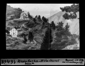
Ried-Mörel is a village and a civic community with a civic council in the Ostlich Raron district and a parish of the Brig dean's office in the Swiss canton of Valais . It was a separate political municipality until November 1st, 2003 when it merged with Goppisberg and Greich to form the municipality of Riederalp .
history
Mancapan Castle, seat of the Counts of Mörel, was destroyed in 1260 by Count Peter II of Savoy and can still be seen as a ruin. Suonen , first mentioned in 1385, supplied the village with water from the Aletsch Glacier , which has been conducted through the Riederhorn in a three-kilometer tunnel since 1946. Until after the Second World War , the community was dominated by agriculture and cattle breeding, while in 2000 58% of the population worked in tourism.
population
| Population development | ||||
|---|---|---|---|---|
| year | 1850 | 1900 | 1950 | 2000 |
| Residents | 302 | 333 | 292 | 304 |
literature
- Anton Riva: Ried-Mörel. In: Historical Lexicon of Switzerland .
Bettmeralp | Bister | Bitsch | Grengiols | Mörel fillet | Riederalp
Former parishes: Betten | Fillet | Goppisberg | Greich | Martisberg | Mörel | Ried-Mörel
Canton of Valais | Districts of the canton of Valais | Municipalities of the canton of Valais