Rochester, New Hampshire
| Rochester | ||
|---|---|---|
| Nickname : The Lilac City | ||
|
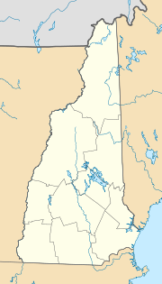
Location in New Hampshire
|
||
| Basic data | ||
| Foundation : | 1749 | |
| State : | United States | |
| State : | New Hampshire | |
| County : | Strafford County | |
| Coordinates : | 43 ° 18 ′ N , 70 ° 58 ′ W | |
| Time zone : | Eastern ( UTC − 5 / −4 ) | |
| Residents : | 30,345 (as of 2016) | |
| Population density : | 259.6 inhabitants per km 2 | |
| Area : | 118.6 km 2 (about 46 mi 2 ) of which 116.9 km 2 (about 45 mi 2 ) is land |
|
| Height : | 69 m | |
| Postcodes : | 03800-03899 | |
| Area code : | +1 603 | |
| FIPS : | 33-65140 | |
| GNIS ID : | 0869554 | |
| Website : | www.rochesternh.net | |
| Mayor : | John Larochelle | |
Rochester is a city in New Hampshire in the United States . It is the largest city in Strafford County and has a population of around 30,000 (2016 estimate, US Census Bureau ).
geography
The city has an area of 118.6 km², of which 116.9 km² is land and 1.6 km² (1.38%) is water.
Rochester is located in the catchment area of the Salmon Falls , Isinglass and Cocheco Rivers . The highest point in Rochester is Nute Ridge ( 177 m ), located in the northern part of the city.
City structure
Rochester consists of the following districts:
- East Rochester
- Gonic
- Rochester
history
The Rochester settlement was founded in 1749 and incorporated in 1778.
On November 30, 2007, a 46-year-old man took several hostages at a Hillary Clinton presidential election office in Rochester, making the place internationally known. After six hours, the hostage situation ended bloodlessly.
sons and daughters of the town
- Isaac Adams (1802-1883), inventor
- Lyndon LaRouche (1922–2019), political activist ("LaRouche Movement")
- James Foley (1973-2014), journalist
- Brandon Rogers (* 1982), German-American ice hockey player
Web links
- History of Rochester ( April 7, 2006 memento on the Internet Archive )
Individual evidence
- ↑ Hostage-taking ended in Clinton office (tagesschau.de archive)
