Roswell (Georgia)
| Roswell | ||
|---|---|---|
|
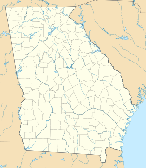
Location in Georgia
|
||
| Basic data | ||
| Foundation : | 1854 | |
| State : | United States | |
| State : | Georgia | |
| County : | Fulton County | |
| Coordinates : | 34 ° 2 ′ N , 84 ° 21 ′ W | |
| Time zone : | Eastern ( UTC − 5 / −4 ) | |
| Residents : | 87,807 (as of 2006) | |
| Population density : | 891.4 inhabitants per km 2 | |
| Area : | 100 km 2 (approx. 39 mi 2 ) of which 98.5 km 2 (approx. 38 mi 2 ) are land |
|
| Height : | 350 m | |
| Postcodes : | 30075-30077 | |
| Area code : | +1 770 & 678 | |
| FIPS : | 13-67284 | |
| GNIS ID : | 0332929 | |
| Website : | www.roswellgov.com | |
| Mayor : | Jere Wood | |
Roswell is a city in Fulton County , Georgia, United States and a suburb of Atlanta . The population was estimated at 101,851 in 2008. Roswell is the seventh largest city in Georgia.
Roswell was ranked third in the 2006 book Best Places to Raise Your Family .
history
In 1830, while on a trip to North Georgia, the plantation owner Roswell King passed through what is now Roswell, where he saw great potential for building a cotton mill on Vickery (Big) Creek . Since the land nearby was also good for plantations, he soon came back to build a mill. He brought 36 enslaved African Americans with him from his own coastal plantation and bought 42 more in Darien to build the mill and all associated houses. Soon his son Barrington King and others moved in, bringing new slaves and setting up their own plantations. On February 16, 1854, the City of Roswell was finally incorporated.
During the Civil War , Roswell was occupied by Union forces. The mills were burned down, but the houses remained intact. The soldiers sent the mill workers north to prevent them from going back to work after the mills were rebuilt. After the war, Barrington King rebuilt the mills and was soon able to resume production. While many free African Americans stayed in the area and worked as paid laborers on the plantations, others went to Fulton County and Atlanta in search of new opportunities. The south suffered an agricultural depression as a result of the effects of the war and changed working conditions.
Demographics
According to the United States Census 2000 , 79,334 residents lived in 30,207 households. The population consisted of 81.51% white, 8.54% black and 3.74% Asian. Hispanics or Latinos made up 10.61% of the population. The per capita income was estimated at $ 40,106 in 2007 and 5.0% of the population was below the poverty line .
traffic
Roswell is connected to five state routes, namely Georgia State Routes 9 , 92 , 120 , 140 and 400 . The nearest airports are Dekalb Peachtree Airport in Chamblee 27 km south of Roswell and Cobb County McCollum Airport in Kennesaw 25 km to the west. The Atlanta airport , the airport with the largest passenger volume, is located 50 km south of Roswell.
Individual evidence
- ↑ Bert Sperling, Peter Sander: Best Places to Raise Your Family: The Top 100 Affordable Communities in the US (= Frommer's ), 1st Edition. Edition, John Wiley & Sons , May 8, 2006, ISBN 0471746991 .
