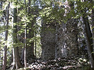
Thürndl ruins
| Thürndl ruins | ||
|---|---|---|
|
Thürndl ruins |
||
| Alternative name (s): | Schozzries | |
| Creation time : | 13th Century | |
| Castle type : | Hilltop castle | |
| Conservation status: | ruin | |
| Place: | Marktschellenberg | |
| Geographical location | 47 ° 41 '4.4 " N , 13 ° 5' 0.9" E | |
|
|
||
The Thürndl ruin (formerly called "Schozzries" or "Schoßrisen") is the ruin of a hilltop castle on the southern corner of a mountain ridge that extends from the Barmsteinen to above Hallein . The location is 300 meters east of the municipality boundary of Marktschellenberg , which forms the state border between Germany and Austria, and belongs to the area of the city of Hallein.
history
Thürndl is probably the cornerstone of a medieval fortification from the 13th century. From the northern city gate, the so-called "Salzburg Gate", a connecting wall is said to have led through the Bannwald up to the Thürndl ruins.
In 1271, the Berchtesgaden Abbey gave the Salzburg Cathedral Chapter a salt mine near the Schozris farm. In the middle of the 14th century, the monastery of St. Peter made a contribution to the "Pau Schozris". In 1583 Andree Mitterlechner received the post of gamekeeper on the "Thurn an der Schosrissen", at the same time he was commissioned with the castle hat and moved into his apartment there. The castle is still shown on a map of Berchtesgaden from 1628. A townscape of Hallein, made in 1632 by Johann Faistenauer , shows, next to the main building on the terrain spur, a second lower-lying object crowned with battlements, which could be the now-defunct gate with a kennel.
On February 21, 1879, the tower became the property of the Hallein municipality, which is still the owner today.
Thürndl ruins today
The still existing tower has the basic dimensions of about 9 by 10 meters. From its formerly four storeys, 15 meter high wall remains have been preserved on the north and east sides. These show a crenellated end with projecting cornices. Further excavations have been commissioned by the Federal Monuments Office, as more precise information about the dimensions of the former corner tower of the old city fortifications is hoped for.
Since there was a risk of large amounts of stone being demolished from the ruins on the Arnoweg , planning of restoration work began in October 2003 and was completed in 2008. The State of Salzburg took on half of the renovation costs, the other half was shared by the Hallein municipality, the Federal Monuments Office and private sponsors.
Coming from Hallein, the structure can be reached via Antoniusweg, Dürrnberg-Landesstraße and Kleinkirchentalweg. Follow this for a few meters to the information board, then to the right via wooden steps on the Bürgermeister-Alois-Oedl-Steig (path no. 459) through the forest to the Thürndl ruins.
A second path with very slight inclines leads from the end of the Barmsteinweg in Bavaria, starting at the restaurant at the foot of the Kleiner Barmstein, which was newly opened in 2012, and over the almost flat mountain ridge in about 15 minutes.
literature
- Friederike Zaisberger , Walter Schlegel: Castles and palaces in Salzburg. Flachgau and Tennengau. Verlag Niederösterreichisches Pressehaus, St. Pölten 1992, ISBN 3-85326-957-5 .
Web links
- Thürndl ruins in my district
- Thürndl ruins . In: Salzburger Nachrichten : Salzburgwiki .
- Thürndl ruins on a castle empire


