
Sägmühle (Treffelstein)
Sägmühle is a district of the municipality of Treffelstein in the Upper Palatinate district of Cham in Bavaria .
|
Sägmühle
Sägmühle (Treffelstein) Community of Treffelstein
Coordinates: 49 ° 25 ′ 3 " N , 12 ° 35 ′ 58" E
|
||
|---|---|---|
| Height : | 490 m | |
| Postal code : | 93492 | |
| Area code : | 09673 | |
Location of Sägmühle in Bavaria |
||
 Sägmühle today's property
|
||

Geographical location
The desert Sägmühle is located about one and a half kilometers southwest of Treffelstein near the Silbersee .
history
The original place Sägmühle is today (2013) flooded by the water of the Silbersee. Only the former mill moat and some ruins, in which a water wheel was recently installed, are still preserved.
A hammer forge already existed here around 1300. It perished during the Thirty Years' War . After the end of this war, iron production was initially resumed, but could not prevail against the competition. The sawmill was then used as a grain mill with two gears and for wood cutting with a full gate . Boxes were made from the cut wood and pearl fishing was carried out in the Bavarian Schwarzach .
At the sawmill there was a chapel with a way of the cross in reverse glass painting. The Sägmühlkapelle received the bell from the castle chapel when the Treffelsteiner church was built in 1727 and kept this bell even during the Second World War .
In a report from the regional directorate, Sägmühle was listed on May 2, 1806 as belonging to the Biberbach branch with 13 residents. In 1837 the sawmill was listed in the diocesan register with one house and 11 residents. She came on October 1, 1840 from the district court district Neunburg vorm Wald to the royal district court Waldmünchen . In 1845 it was noted that there were 2 house numbers with 11 residents in Sägmühle. It had two grinders and a cutting saw. In addition to the saw and mill, the inhabitants of Sägmühle ran cattle breeding: horses, oxen and pigs with good success. In 1863 the sawmill was listed in the diocesan register with one house and 12 residents as belonging to Treffelstein. On March 23, 1913 (Easter), Sägmühle was listed as part of the Treffelstein branch with one house and 14 residents.
When the Silbersee was built in 1968, two properties sank into the water: Xaver Preisser's farm, which was compensated with 80,000 DM, and the sawmill, including the chapel by Margarete Kölbl, received 350,000 DM in compensation. The 200-year-old bell of the Sägmühl chapel disappeared without a trace in the Amberg water management office.
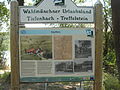
Information board

Former mill moat

Ruin with water wheel


Web links
- Website of Treffelstein
- Sägmühle (Treffelstein) in the location database of the Bayerische Landesbibliothek Online . Bavarian State Library, accessed on August 23, 2020.
Individual evidence
- ↑ Fritsch hiking map of the Upper Bavarian Forest, nature park , scale 1: 50,000
- ^ A b Josef Kraus: Treffelstein. A home book. , Treffelstein 1971, p. 352
- ^ Josef Kraus: Treffelstein. A home book. , Treffelstein 1971, pp. 351, 352
- ^ Josef Kraus: Treffelstein. A home book. , Treffelstein 1971, p. 171
- ^ Josef Kraus: Treffelstein. A home book. , Treffelstein 1971, p. 181
- ^ A b Josef Kraus: Treffelstein. A home book. , Treffelstein 1971, p. 182
- ^ Josef Kraus: Treffelstein. A home book. , Treffelstein 1971, p. 239
- ^ Antonius von Henle (Ed.): Register of the Diocese of Regensburg. Verlag der Chanzlei des Bischöflichen Ordinariates Regensburg, 1916, p. 365
- ^ Josef Kraus: Treffelstein. A home book. , Treffelstein 1971, p. 350

Altenried | Biberbach | Birkhof | Braunmühle | Edlmühl | Fürstenhof | Kleeberg | Kleinsteinlohe | Kritzenthal | Lintl hammer | Mouse Tower | Sawmill | Steinlohe | Stratsried | Treffelstein | Witzelsmühle | Doubthof
former districts: Schladerlmühle