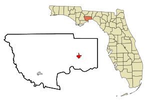
Saint Marks (Florida)
| Saint Marks | |
|---|---|
|
County and state location
|
|
| Basic data | |
| State : | United States |
| State : | Florida |
| County : | Wakulla County |
| Coordinates : | 30 ° 10 ′ N , 84 ° 12 ′ W |
| Time zone : | Eastern ( UTC − 5 / −4 ) |
| Residents : | 293 (as of 2010) |
| Population density : | 58.6 inhabitants per km 2 |
| Area : | 5.0 km 2 (approx. 2 mi 2 ) of which 5.0 km 2 (approx. 2 mi 2 ) is land |
| Height : | 3 m |
| FIPS : | 12-62825 |
| GNIS ID : | 0290282 |
| Website : | cityofstmarks.com |
| Mayor : | Gail Gilman |
Saint Marks is a city in Wakulla County in the US state of Florida with 293 inhabitants (as of 2010).
geography
St. Marks is located at the confluence of the St. Marks River with the Wakulla River . The city is located around 20 km east of Crawfordville and around 25 km south of Tallahassee .
The city is passed by the Florida Trail .
history
The place was founded in the 17th century by the Spanish at the time of the Spanish colony of Florida under the name of San Marcos de Apalache . The San Marcos de Apalache Historic State Park , located directly at the mouth of the river, on the southern edge of the city, is a reminder of this time.
The Tallahassee Railroad opened in 1837, making it one of the first railroad lines in what is now Florida. It connected St. Marks on a 35 km long route with Tallahassee, the then capital of the Florida Territory . From 1839 to 1843 there was an extension to Port Leon directly on the Gulf coast , which had to be stopped after being destroyed by a hurricane . In 1983 the route was finally shut down by the Seaboard Coast Line Railroad and the route was sold to the Florida Department of Transportation . Today Tallahassee-St. Marks Historic Railroad State Trail .
Demographic data
According to the 2010 census, the then 293 inhabitants were distributed over 187 households. The population density was 58.6 inh / km². 96.9% of the population identified themselves as white, 1.7% as African-American , 0.3% as Native American and 0.3% as Asian Americans . 0.7% said they belonged to several ethnic groups.
In 2010 children under 18 years of age and 24.8% of all households lived in 21.4% of all households with persons at least 65 years of age. 54.5% of households were family households (consisting of married couples with or without offspring or a parent with offspring). The average household size was 2.02 people and the average family size was 2.62 people.
18.5% of the population were younger than 20 years old, 19.4% were 20 to 39 years old, 39.6% were 40 to 59 years old, and 22.5% were 60 years or older. The mean age was 47 years. 49.1% of the population were male and 50.9% were female.
The median annual income was $ 58,750, with 4.5% of the population living below the poverty line.
In 2000, English was the mother tongue of 100% of the population.
Attractions
The Fort San Marcos de Apalache and the St. Marks Lighthouse in St. Marks National Wildlife Refuge are in National Register of Historic Places listed.
traffic
The nearest airport is Tallahassee International Airport (around 30 km north).
Web links
- Website of the city (Engl.)
Individual evidence
- ^ Gregg Turner: A Short History of Florida Railroads. Arcadia Publishing , Mount Pleasant 2014, ISBN 978-1-439642-54-2 , p. 14.
- ^ Profile of General Population and Housing Characteristics: 2010. United States Census Bureau , accessed June 11, 2015 .
- ^ Language distribution 2000. Modern Language Association , accessed June 11, 2015 .
- ↑ FLORIDA - Wakulla County. National Register of Historic Places , accessed June 11, 2015 .

