Salmendingen
|
Salmendingen
City of Burladingen
|
|
|---|---|
| Coordinates: 48 ° 21 ′ 28 " N , 9 ° 7 ′ 11" E | |
| Height : | 807 m above sea level NN |
| Residents : | 738 (Dec. 31, 2019) |
| Incorporation : | 1st January 1973 |
| Postal code : | 72393 |
| Area code : | 07126 |
|
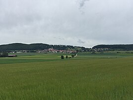
Salmendingen, north view
|
|
Salmendingen is a village in the Swabian Alb in Baden-Württemberg . It is 807 m above sea level. NN and has 738 inhabitants (as of December 31, 2019). Salmendingen has belonged to the city of Burladingen, 10.5 kilometers south, since 1973 .
history
Burial mounds of a prehistoric settlement were discovered in the area around Salmendingen. The ending -ingen of the place name indicates an Alemannic settlement.
The family of the Lords of Salmendingen, attested from 1245 to 1392, built the castle above the place , which was no longer inhabited by 1386. The basic rule had in the 13th century, the Lords of Hohenberg , from 1401 the place belonged to the rule Trochtelfingen and fell with this 1534 to the House Furstenberg where the place remained until 1806th The place now came to the Principality of Hohenzollern-Sigmaringen , which was added to the Kingdom of Prussia in 1850 .
In 1925 Salmendingen came to the district of Hechingen and on January 1, 1973 the previously independent town was incorporated into Burladingen.
Salmendingen had 620 inhabitants in 1824, 784 in 1848 and 593 in 1890.
On January 1, 1973 Salmendingen was incorporated into Burladingen.
coat of arms
The coat of arms of the formerly independent town shows in a split shield in front in silver three overturned black wolf rods on top of one another, in the back a three-lap silver flag in black .
The right part of the coat of arms with the black wolf fish comes from the coat of arms of the Lords of Salmendingen (13th and 14th centuries). The left part with the three-lobed silver flag, the coat of arms of the Counts of Werdenberg zu Trochtelfingen, commemorates the rule of the Werdenbergs from 1401 to 1534.
Attractions
- The Salmendinger Chapel on the Kornbühl near the village
- The Salmendingen ruins immediately to the south
- Catholic Parish Church of St. Michael
literature
- Erhard Lazi : The Zollernalb district . Konrad Theiss Verlag , Stuttgart 1979, ISBN 3-8062-0205-2 , pp. 289-290.
Web links
Individual evidence
- ^ Federal Statistical Office (ed.): Historical municipality directory for the Federal Republic of Germany. Name, border and key number changes in municipalities, counties and administrative districts from May 27, 1970 to December 31, 1982 . W. Kohlhammer, Stuttgart / Mainz 1983, ISBN 3-17-003263-1 , p. 529 .
- ^ Website of the place - coat of arms


