
Samarskoye (Rostov)
| Village
Samarskoye
Самарское
|
||||||||||||||||||||||||||||||||
|
||||||||||||||||||||||||||||||||
|
||||||||||||||||||||||||||||||||
| List of large settlements in Russia | ||||||||||||||||||||||||||||||||
.svg)

Samarskoje ( Russian Сама́рское ) is a village (selo) in Rostov Oblast in Russia with 10,530 inhabitants (as of October 14, 2010).
geography
The place is a good 30 km as the crow flies south of the Rostov-on-Don Oblast Administrative Center on the right bank of the Kagalnik , a tributary of the Sea of Azov , below the confluence of the left tributary Elbusd.
Samarskoye belongs to the Asovsky Rajon and is located almost 30 km southeast of its administrative center Azov . The village is the seat of the rural community Samarskoye selskoye posselenije, which also includes the settlements Oporny and Sukhodolsk (both about 7 km north), the village Novonikolajewka (7 km north-west) and the hamlet (chutor) Kochevanchik (5 km north-west).
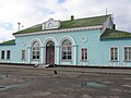
Kajala train station

School No. 4 in Samarskoye


history
The place arose in the second half of the 18th century. The year of foundation is 1770. The name goes back to the name of the first settler Samartschenko. From 1915 to 1924 the village was the administrative seat of a Volost , from 1935 to 1963 of a Rajons named after him.
Population development
| year | Residents |
|---|---|
| 1863 | 3,516 |
| 1897 | 3,828 |
| 1915 | 6,018 |
| 1939 | 6,950 |
| 1959 | 8,651 |
| 1979 | 10,714 |
| 2002 | 10,654 |
| 2010 | 10,530 |
Note: 1897, from 1939 census data
traffic
The federal highway M4 Don Moscow - Rostov-on-Don - Krasnodar - Novorossiysk (also European route 115 ) runs on the eastern outskirts of Samarskoje . From there the regional road 60N-52 branches off, which leads through the village, crosses the Kagalnik and first descends on its left side and then leads north to the district center of Azov.
In the village is the Kajala railway station at kilometer 1381 (from Moscow) of the Rostov - Vladikavkas / Makhachkala - Baku railway line, which opened on this section in 1875 and has been electrified since 1962 .
Web links
- Official website of the local government (Russian)
Individual evidence
- ↑ a b Itogi Vserossijskoj perepisi naselenija 2010 goda. Tom 1. Čislennostʹ i razmeščenie naselenija (Results of the All-Russian Census 2010. Volume 1. Number and distribution of the population). Tables 5 , pp. 12-209; 11 , pp. 312–979 (download from the website of the Federal Service for State Statistics of the Russian Federation)