San Fernando (California)
| San Fernando | |
|---|---|
|
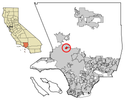
Location in Los Angeles County
|
|
| Basic data | |
| Foundation : | 1911 |
| State : | United States |
| State : | California |
| County : | Los Angeles County |
| Coordinates : | 34 ° 17 ′ N , 118 ° 26 ′ W |
| Time zone : | Pacific ( UTC − 8 / −7 ) |
| Residents : | 23,645 (as of 2010) |
| Population density : | 3,826.1 inhabitants per km 2 |
| Area : | 6.18 km 2 (approx. 2 mi 2 ) of which 6.18 km 2 (approx. 2 mi 2 ) is land |
| Height : | 326 m |
| Postcodes : | 91340, 91341, 91344-91346 |
| Area code : | +1 818 |
| FIPS : | 06-66140 |
| GNIS ID : | 1652786 |
| Website : | www.ci.san-fernando.ca.us |
| Mayor : | Sylvia Ballin (2015-2019) |
San Fernando is a city in Los Angeles County in the US state of California with 23,645 inhabitants (as of 2010).
The city was named after the nearby Mission San Fernando Rey de España and is now completely surrounded by the city of Los Angeles with the districts of Sylmar in the north, Lake View Terrace in the east, Pacoima in the south and Mission Hills in the west. San Fernando is connected to the regional traffic by the freeways (highways) Golden State, Foothill, Ronald Reagan and San Diego. There is also a connection with local public transport via the Antelope Valley Line of the Metrolink suburban train system (Los Angeles) .
While most cities in the San Fernando Valley around Los Angeles agreed to the incorporation in the early 1910s, San Fernando opposed this connection - not least because it wanted to continue to determine its abundant water supplies itself. Even after the development to a more urban form of settlement after the Second World War, San Fernando insisted on its independence.
sons and daughters of the town
- Harold Rhodes (* 1910–2000), inventor of the electronic piano
- Warren Vanders (1930–2009), actor
- Denny Crum (* 1937), former basketball coach
- James W. Fowler (1940-2015), theologian
- Mike Post (* 1944), music producer
- Johnny Legend (* 1948), rockabilly musician, film producer, actor and wrestling promoter
- Jeffery Cotton (1957–2013), composer, writer and computer programmer
- Alex Garcia (born 1961), boxer
- Paula Abdul (* 1962), choreographer and pop singer
- Mike Inez (* 1966), rock musician
- Shannon Chandler (born 1986), actress
Web links
- San Fernando Valley history (English)
- The Valley Economic Alliance (English)
