San Juan National Historic Site
The San Juan National Historic Site is a historic site in San Juan , the capital of the US suburb of Puerto Rico . It is a National Historic Site and part of the UNESCO World Heritage Site of La Fortaleza and San Juan National Historic Site in Puerto Rico .
history
Since Puerto Rico was a mandatory stopping point on the way to the New World for the explorers and colonialists of Puerto Rico , the island quickly became a strategically important point. Between the 15th and 19th centuries, some defenses were built on the island in the Caribbean Sea to protect the city and the Bay of San Juan . Due to the long-running disputes over the island between Spain, France , the United Kingdom and the Netherlands , the site has also witnessed lengthy military conflicts.
National Historic Site
The San Juan National Historic Site includes the following individual structures:
| number | designation | location | image |
|---|---|---|---|
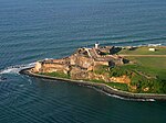
| H-200 | Castillo de San Felipe del Morro | Northwest corner of the island of San Juan ( geocoordinates ) |
 more pictures |
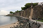
| H-201 | Northern city wall | north of the old town between Castillo del Morro and Castillo San Cristobal ( west end , east end ) |
 more pictures |
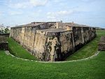
| H-201 | San Cristobal Castle | Northeast corner of the old town ( geographic coordinates ) |
 more pictures |
| H-203 | Big moat with Ravelin San Carlos and Bastion La Trinidad | directly east of the Castillo San Cristobal ( Graben , San Carlos , La Trinidad ) |
|
| H-204 | Santa Teresa Bastion and La Princesa Bastion | east of the Great Ditch ( Santa Teresa , La Princesa ) |
|
| H-205 | Bastion El Abanico | approx. 200 m east of the Castillo San Cristobal ( geographic coordinates ) |
 more pictures |
| H-206 | Southern city wall section 1 | west of the old town between Castillo del Morro and Porta San Juan (exclusively) ( north end , south end ) |
 more pictures |
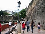
| H-207 | Southern city wall section 2 | from Porta San Juan (inclusive) to Las Palmas Bastion (inclusive) ( west end , east end ) |
 more pictures |
| H-208 | District building 1 | Calle de Norzagaray | |
| H-209 | District building 2 | Calle de Norzagaray directly west of the Castillo San Cristobal ( geographic coordinates ) |
|
| H-210 | District building 3 | Calle de Norzagaray directly west of the Castillo San Cristobal ( geographic coordinates ) |
|
| H-211 | District building 4 | Calle de Norzagaray directly west of the Castillo San Cristobal ( geographic coordinates ) |
|
| H-212 | Fortín San Juan de la Cruz (called El Cañuelo) | South end of Isla de Cabras ( geographic coordinates ) |
 more pictures |
The historic site was built on February 14, 1949, and entered the National Register of Historic Places on October 15, 1966 as a National Historic Site . In 1983 the National Historic Site was added to the list of UNESCO World Heritage Sites along with the La Fortaleza residence, which was declared a National Historic Landmark .
Web links
- La Fortaleza and San Juan National Historic Site on whc.unesco.org
- San Juan National Historic Site on the National Park Service side
Individual evidence
- ^ A b La Fortaleza and San Juan National Historic Site in Puerto Rico. In: whc.unesco.org. UNESCO World Heritage Center, accessed March 6, 2017 .
- ↑ History, general etc.
- ↑ Nomination Form for the San Juan National Historic Site

