Saylorsburg
| Saylorsburg | ||
|---|---|---|
|
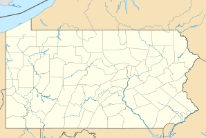
Location in Pennsylvania
|
||
| Basic data | ||
| State : | United States | |
| State : | Pennsylvania | |
| County : | Monroe County | |
| Coordinates : | 40 ° 54 ′ N , 75 ° 19 ′ W | |
| Time zone : | Eastern ( UTC − 5 / −4 ) | |
| Residents : | 1,126 (as of 2010) | |
| Population density : | 375.3 inhabitants per km 2 | |
| Area : | 3.3 km 2 (approx. 1 mi 2 ) of which 3.0 km 2 (approx. 1 mi 2 ) are land |
|
| Height : | 204 m | |
| Postcodes : | 18353 | |
| Area code : | +1 570 | |
| FIPS : | 42-68088 | |
Saylorsburg is a census-designated place in Monroe County in the US state of Pennsylvania with a population of 1126 (2010).
geography
Saylorsburg is in the Pocono Mountains , on Pennsylvania Route 33 and 60 kilometers southeast of Wilkes-Barre . Stroudsburg is located 15 kilometers to the northeast.
history
Various Indian tribes were the indigenous people of the area. At the beginning of the 19th century , the area of today's Saylorsburg was settled by farmers . The name of the place was chosen in honor of the settlers Charles and Samuel Saylor. Since high-quality and extensive clay deposits were discovered in the area , an important branch of industry for brick production developed. Glazed masonry bricks were specially produced.
The Turkish preacher Fethullah Gülen has lived in self-chosen exile in Saylorsburg since 1999 .
Demographic data
In 2010 a population of 1126 was determined. The mean age at this point in time was 42.2 years, above the value of Pennsylvania, which was 40.6 years. 16.5% of today's residents can be traced back to immigrants from Germany. Other significant immigrant groups during the early days of the town came from England ( 13.4%) and Ireland ( 9.5%) .
Individual evidence
- ↑ US Postal Service - ZIP Codes
- ↑ naming
- ↑ Brick production ( Memento from June 24, 2016 in the Internet Archive )
- ↑ City data
Web links
- American Indians - Native to Pennsylvania
