
Rail transport in Mauritius


Rail traffic in Mauritius existed for 100 years, between 1864 and 1964.
history
prehistory
In 1845 it was announced in the press that a joint-stock company called Mauritius Railway Company had been founded with the aim of building a railway between the cities of Port Louis and Mahébourg . However, the railway was not built initially. Similar plans were resumed in 1856, but again led to nothing. In 1858/59 the British colonial administration finally commissioned a feasibility study , which advocated building a railway network on the island.
Railway construction
In 1862 the construction of the Mauritius Government Railway (MGR) began. Their routes were built in standard gauge . The first route ran from the capital, Port Louis, on the west side of the island along the north coast on its east side. It started operating in a first phase in 1864. The following routes were built by MGR:
- Port Louis - Terre Rouge - Rivière Sèche - Grande Rivière Sud-Est (49.9 km)
- Terre Rouge - Montagne Longue (5.6 km)
- Port Louis - Richelieu - Rose Hill - Rose Belle - Mahébourg (59.9 km)
- Richelieu - Tamarin (20.8 km)
- Rose Hill - Rivière Sèche (41.4 km)
- Rose Belle - Soulliac (17.2 km)
The MGR also operated a cable car in Soulliac from 1878 to 1905 .
In addition, a number of narrow-gauge railways in numerous gauges have been built for plantations and sawmills , including: 1000 mm (?), 950 mm, 946 mm, 940 mm, 930 mm, 925 mm, 920 mm, 914 mm, 838 mm, 813 mm , 810 mm, 805 mm, 800 mm, 775 mm, 770 mm, 762 mm, 750 mm and 600 mm. There was also a monorail for the transport of wood in the forest of Kanaka.
business
At the height of the operation, the MGR had to vehicles 52 steam locomotives , including six Garrattlokomotiven of Beyer-Peacock , 200 coaches and 750 freight cars . During the Second World War , passenger traffic was stopped on some routes from 1939 to 1942/43, but was then resumed, but was finally stopped in 1963. Exactly 100 years after the first railway line went into operation, rail traffic on Mauritius was completely abandoned in 1964.

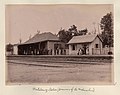
Port Louis train station

Souillac train station
Mahébourg train station


future
In 2017, the construction of a light rail began. It will lead from the capital Port Louis through its densely populated agglomeration south to Curepipe . The route is to be 26 km long and serve 20 stops. The infrastructure is being built by the Indian company Larsen & Toubro . 18 trains have been ordered from the Spanish Construcciones y Auxiliar de Ferrocarriles (CAF).
Route network
| Port Louis – Grande Rivière Sud-Est railway line | |||||||||||||||||||||||||||||||||||||||||||||||||||||||||||||||||||||||||||||||||||||||||||||||||||||||||||||||||||||||||||||||||||||
|---|---|---|---|---|---|---|---|---|---|---|---|---|---|---|---|---|---|---|---|---|---|---|---|---|---|---|---|---|---|---|---|---|---|---|---|---|---|---|---|---|---|---|---|---|---|---|---|---|---|---|---|---|---|---|---|---|---|---|---|---|---|---|---|---|---|---|---|---|---|---|---|---|---|---|---|---|---|---|---|---|---|---|---|---|---|---|---|---|---|---|---|---|---|---|---|---|---|---|---|---|---|---|---|---|---|---|---|---|---|---|---|---|---|---|---|---|---|---|---|---|---|---|---|---|---|---|---|---|---|---|---|---|---|
| Route length: | 49.9 km | ||||||||||||||||||||||||||||||||||||||||||||||||||||||||||||||||||||||||||||||||||||||||||||||||||||||||||||||||||||||||||||||||||||
| Gauge : | 1435 mm ( standard gauge ) | ||||||||||||||||||||||||||||||||||||||||||||||||||||||||||||||||||||||||||||||||||||||||||||||||||||||||||||||||||||||||||||||||||||
|
|||||||||||||||||||||||||||||||||||||||||||||||||||||||||||||||||||||||||||||||||||||||||||||||||||||||||||||||||||||||||||||||||||||
| Port Louis – Mahébourg railway line | |||||||||||||||||||||||||||||||||||||||||||||||||||||||||||||||||||||||||||||||||||||||||||||||||||||||||||||||||||||||||||||||||||||||||||||||||||||||||||||||||||||||||||||||||||||||||||||||||||||||||||||||||||||
|---|---|---|---|---|---|---|---|---|---|---|---|---|---|---|---|---|---|---|---|---|---|---|---|---|---|---|---|---|---|---|---|---|---|---|---|---|---|---|---|---|---|---|---|---|---|---|---|---|---|---|---|---|---|---|---|---|---|---|---|---|---|---|---|---|---|---|---|---|---|---|---|---|---|---|---|---|---|---|---|---|---|---|---|---|---|---|---|---|---|---|---|---|---|---|---|---|---|---|---|---|---|---|---|---|---|---|---|---|---|---|---|---|---|---|---|---|---|---|---|---|---|---|---|---|---|---|---|---|---|---|---|---|---|---|---|---|---|---|---|---|---|---|---|---|---|---|---|---|---|---|---|---|---|---|---|---|---|---|---|---|---|---|---|---|---|---|---|---|---|---|---|---|---|---|---|---|---|---|---|---|---|---|---|---|---|---|---|---|---|---|---|---|---|---|---|---|---|---|---|---|---|---|---|---|---|---|---|---|---|---|---|---|---|
| Route length: | 60.2 km | ||||||||||||||||||||||||||||||||||||||||||||||||||||||||||||||||||||||||||||||||||||||||||||||||||||||||||||||||||||||||||||||||||||||||||||||||||||||||||||||||||||||||||||||||||||||||||||||||||||||||||||||||||||
| Gauge : | 1435 mm ( standard gauge ) | ||||||||||||||||||||||||||||||||||||||||||||||||||||||||||||||||||||||||||||||||||||||||||||||||||||||||||||||||||||||||||||||||||||||||||||||||||||||||||||||||||||||||||||||||||||||||||||||||||||||||||||||||||||
|
|||||||||||||||||||||||||||||||||||||||||||||||||||||||||||||||||||||||||||||||||||||||||||||||||||||||||||||||||||||||||||||||||||||||||||||||||||||||||||||||||||||||||||||||||||||||||||||||||||||||||||||||||||||
| Richelieu - Rivière Sèche railway line | |||||||||||||||||||||||||||||||||||||||||||||||||||||||||||||||||||||||||||||||||||||
|---|---|---|---|---|---|---|---|---|---|---|---|---|---|---|---|---|---|---|---|---|---|---|---|---|---|---|---|---|---|---|---|---|---|---|---|---|---|---|---|---|---|---|---|---|---|---|---|---|---|---|---|---|---|---|---|---|---|---|---|---|---|---|---|---|---|---|---|---|---|---|---|---|---|---|---|---|---|---|---|---|---|---|---|---|---|
| Route length: | 41.4 km | ||||||||||||||||||||||||||||||||||||||||||||||||||||||||||||||||||||||||||||||||||||
| Gauge : | 1435 mm ( standard gauge ) | ||||||||||||||||||||||||||||||||||||||||||||||||||||||||||||||||||||||||||||||||||||
|
|||||||||||||||||||||||||||||||||||||||||||||||||||||||||||||||||||||||||||||||||||||
literature
- Tristan Bréville: Le Dernier Train. Un romanquête. Musée de la Photographie, Mauritius 2005, ISBN 99903-36-21-0 (in French).
- Arthur Jessop: A History of the Mauritius Government Railways, 1864 to 1964. J. Eliel Félix, Port Louis 1964.
- Neil Robinson: World Rail Atlas and historical summary. Vol. 7: North, East and Central Africa. World Rail Atlas Ltd., p. l. 2009, ISBN 978-954-92184-3-5 , p. 54, maps 72-76.
Web links
Individual evidence
- ↑ mr: Metro for Mauritius . In: Eisenbahn-Revue International 10 (2017), ISSN 1421-2811, pp. 514f.
- ↑ The line has been operated by the MGR since 1936. It was probably a narrow-gauge railway of unknown gauge and not a connection to the standard-gauge main line. (Robinson, p. 53.)
Egypt |
Algeria |
Angola |
Equatorial Guinea |
Ethiopia |
Benin |
Botswana |
Burkina Faso |
Burundi |
Djibouti |
Ivory Coast |
Eritrea |
Gabon |
Gambia |
Ghana |
Guinea |
Guinea-Bissau |
Cameroon |
Cape Verde |
Kenya |
Comoros |
Congo (Dem. Rep.) |
Congo, Republic of |
Lesotho |
Liberia |
Libya |
Madagascar |
Malawi |
Mali |
Morocco |
Mauritania |
Mauritius |
Mozambique |
Namibia |
Niger |
Nigeria |
Rwanda |
Zambia |
São Tomé and Príncipe |
Senegal |
Seychelles |
Sierra Leone |
Zimbabwe |
Somalia |
South Africa |
Sudan |
South Sudan |
Swaziland |
Tanzania |
Togo |
Chad |
Tunisia |
Uganda |
Western Sahara |
Central African Republic
Other areas of
Ceuta |
Canaries |
Réunion |
St. Helena, Ascension and Tristan da Cunha