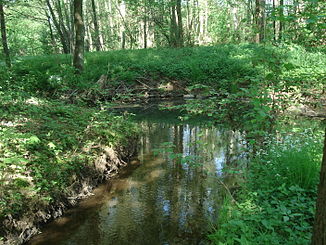
Nonnenbach (Aschaff)
|
Nonnenbach ( Historically : Schmerlenbach ) |
||
|
The Nonnenbach in front of its mouth |
||
| Data | ||
| location |
Spessart
|
|
| River system | Rhine | |
| Drain over | Aschaff → Main → Rhine → North Sea | |
| origin | Confluence of the Winzenhohler Bach and Schmerlenbach at Schmerlenbach Abbey 49 ° 59 ′ 15 ″ N , 9 ° 13 ′ 43 ″ E |
|
| Source height | 170 m above sea level NHN (at the confluence) | |
| muzzle | north of Hösbach - train station in the Aschaff Coordinates: 50 ° 0 ′ 8 " N , 9 ° 13 ′ 58" E 50 ° 0 ′ 8 " N , 9 ° 13 ′ 58" E |
|
| Mouth height | 145 m above sea level NHN | |
| Height difference | 25 m | |
| Bottom slope | 13 ‰ | |
| length | 1.9 km from the confluence 4.3 km with Schmerlenbach |
|
| Catchment area | 6.8 km² | |
| Left tributaries | Baschklingebach | |
|
The Nonnenbach (front) flows into the Aschaff (back) |
||
The Nonnenbach is a left tributary of the Aschaff in the district of Aschaffenburg in the Bavarian Spessart . It arises at the Schmerlenbach Monastery from the confluence of the Winzenhohler Bach and Schmerlenbach .
geography
Spring streams
Loach brook
The Schmerlenbach arises in the Schmerlenbacher Wald from the confluence of the Waldbach and Kellerbergbach . It flows to the northeast and takes on the Strietbach . At about 2.3 km (with forest stream ) it is the longer and more water-rich source stream.
The name Schmerlenbach consists of the Middle High German words smërle for loach and bach . He gave the place Schmerlenbach its current name.
Winzenhohler Bach
The approx. 2 km long Winzenhohler Bach rises in Winzenhohl . It flows through the village in a northerly direction and unites at the Schmerlenbach monastery with the Schmerlenbach to form the Nonnenbach .
course
From the confluence of the Nonnenbach flows north. He picks up the Baschklingebach and reaches Hösbach - Bahnhof . There it crosses under the 2307 state road , the Main-Spessart-Bahn and the A 3 route . Then the Nonnenbach flows into the Aschaff .
Tributaries
- Baschklingebach ( left )
Aschaff river system
See also
Web links
Individual evidence
- ↑ Bayernviewer of the Bavarian Surveying Administration: Historical maps from the years 1817–1841 ( Memento of the original from March 4, 2016 in the Internet Archive ) Info: The archive link was inserted automatically and has not yet been checked. Please check the original and archive link according to the instructions and then remove this notice.
- ↑ a b c d e BayernAtlas of the Bavarian State Government ( notes )
- ^ Wolf-Armin von Reitzenstein : Lexicon of Franconian place names. Origin and meaning . Upper Franconia, Middle Franconia, Lower Franconia. CH Beck, Munich 2009, ISBN 978-3-406-59131-0 , p. 199 ( limited preview in Google Book search).


