Schwarzbach (Great Mittweida)
| Schwarzbach | ||
|
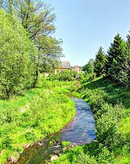
The Schwarzbach between Elterlein and Schwarzbach |
||
| Data | ||
| Water code | DE : 541286 | |
| location | Saxony , Germany | |
| River system | Elbe | |
| Drain over | Große Mittweida → Schwarzwasser → Zwickauer Mulde → Mulde → Elbe → North Sea | |
| source | Hermannsdorf meadows | |
| Source height | approx. 675 m above sea level NHN | |
| muzzle | in Schwarzenberg in the Große Mittweida Coordinates: 50 ° 32 '26 " N , 12 ° 47' 52" E 50 ° 32 '26 " N , 12 ° 47' 52" E |
|
| Mouth height | approx. 434 m above sea level NHN | |
| Height difference | approx. 241 m | |
| Bottom slope | approx. 40 ‰ | |
| length | 6.1 km | |
| Left tributaries | Mühlgraben, Rotbach | |
| Right tributaries | Wiesenbach, Schlangenbach | |
|
Tributaries and hydraulic structures
|
||||||||||||||||||||||||||||||||||||||||||||||||||||||
The Schwarzbach is a river in the western Ore Mountains.
etymology
The river bears the same name as the settlement first mentioned in 1240 as "Swartzpach".
course
The Schwarzbach rises from many individual sources in the Hermannsdorfer Wiesen nature reserve in the Geyerschen Forest near the Black Pond on Elterleiner Flur. After the Schlangenbach and Wiesenbach flow into the Schwarzbach, among other things , it flows around the town of Elterlein , passes the Elterlein sports field and crosses under Scheibenberger Straße. Now the Schwarzbachtal opens and the river crosses the place that owes its name to the Schwarzbach. The Mühlgraben with the mill and bakery Doering and the Rotbach / Rote Bach flow here . It leaves Schwarzbach to the southwest and continues through Langenberg , where it starts at the inn "St. Katharina" to meander its way to Schwarzenberg . Here it flows into the Große Mittweida shortly after entering the town .
literature
- Gisela Gasde: Schwarzbach - a Waldhufendorf . Schwarzbach 1994.
- Gisela Gasde: Schwarzbach - our beautiful village 1945–89 . Schwarzbach 1995.
Individual evidence
- ↑ a b c Saxony Atlas of the Free State of Saxony ( notes )
