Geyerscher forest
The Geyersche Forest is an approximately 65 km², contiguous forest area in the Middle Ore Mountains . It extends over the flat undulating Geyersche plateau (also called Geyersche Platte ) and its edges.
Location and surroundings
The Geyersche Forest is located between the towns of Elterlein , Geyer , Thum and Zwönitz , about 25 km south of Chemnitz . The highest point of the area is 744 m above sea level.
geography
The plateau of the Geyers forest is an isolated, far north located elevation in the Ore Mountains . Its edges rise 100 to 150 m above the surrounding area, even in the direction of the mountain roof.
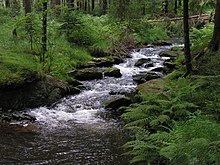
Most of the area is drained via the Greifenbach and Geyerbach in the Zschopau . On the western edge of the plateau rises part of the Zwönitz source arms and the area around the Greifensteine in the northeast feeds the Wilisch , another tributary of the Zschopau.
The Greifensteine form, with the seven 20 to 30 m high granite cliffs and an absolute height of up to 731 m above sea level. NN , a prominent point on the northeastern edge of the area.
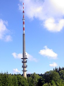
At the highest point of the Geyer Forest is the 193 m high Geyer television tower .
climate
The isolated location of Geyer's plate causes congestion rain in every wind direction due to windward effects on all sides . The average rainfall in this area is 1000 mm / year and the climate is generally rougher and cooler than in the surrounding area. The climatic conditions of the exposed area therefore correspond to those of the high altitudes of the Ore Mountains, which only begin about 100 m higher.
nature
Also geobotanisch the Geyersche plateau is assigned to the upper regions of the Ore. Since the climatic conditions are unfavorable for agriculture, one of the northernmost large forest areas of the Ore Mountains has been preserved here. Originally there was an almost pure coniferous forest with a predominant proportion of spruce . Regulated forestry has shaped the forest since the beginning of the 19th century. After the Second World War , beech and fir trees began to be mixed into the existing structure in order to create a mixed forest .
The humid climate led to bogs in several places. On the northern edge of the Geyers forest is at 670 m above sea level. NN, for example, the 3.69 hectare nature reserve Hormersdorfer Hochmoor and on the southern edge at about 650 m above sea level. NN . the 185.00 hectare nature reserve Hermannsdorfer Wiesen .
history
Elector August I of Saxony donated the forest area to the city of Geyer in 1565, with which the wood needs of the mining and metallurgy of the mining town should be secured. This high demand, alone the Gifthütte Geyer at the Greifenbachstauweiher required half of the logging, led to the destruction of the original forest at that time.
Source / literature
- Between Zwickauer Mulde and Geyerschem Wald (= values of our homeland . Volume 31). 1st edition. Akademie Verlag, Berlin 1978.
Coordinates: 50 ° 37 ′ 21 ″ N , 12 ° 52 ′ 13 ″ E

