Selayar
| Selayar | ||
|---|---|---|
| Waters | Lake Flores , Lake Banda | |
| Archipelago | Selayar Islands | |
| Geographical location | 6 ° 5 ′ S , 120 ° 30 ′ E | |
|
|
||
| length | 81.4 km | |
| width | 13.1 km | |
| surface | 832 km² | |
| Highest elevation | 1780 m | |
| Residents | 98,000 118 inhabitants / km² |
|
| main place | Benteng | |
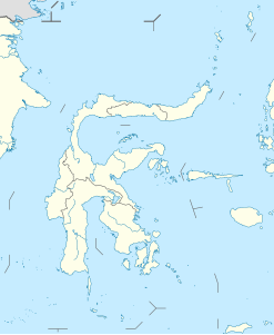
Selayar , Indonesian Pulau Selayar , other spellings selayar island, Saleijer, Salayar, Silaijara , is south of Sulawesi situated Indonesian island and part of the island chain, as defined by the International Hydrographic Organization , the Flores Sea from the Banda Sea separates.
Selayar, together with some of the secondary islands ( Pasi Tallu , Gusung Tallang , Bahuluang , Kalao , Bonerate , Kajuwadi , Jampea , Lalao (also Lambego), Kalaotoa and others ) covers 832 km² (81.4 km from north to south and 13.1 km from West to East), and forms the administrative district of the Selayar Islands ( Kabupaten Kepulauan Selayar ) in the Sulawesi Selatan Province with 98,000 inhabitants. The headquarters of the Kabupaten is Benteng (Indonesian for "fortress, fort"). Other places are Bonelohe, Padang, Barangbarang. Fort Benteng Bontobangun is located south of Benteng.
All the islands in the group are flat and fertile, but some are also stony, such as Pasi Tallu, overgrown with bushes and sandy. Only the main island is crossed by a sandstone mountain range that rises to 1780 meters. The coasts are lined with coral reefs . The island is best known for its sandy beaches and as a diving area .
The inhabitants are predominantly Muslim Bugis , Macassars and Konjo .
Web links
- Selayar Island (eng.)
Individual evidence
- ↑ Limits of Oceans and Seas, 3rd edition (PDF; 994 kB) International Hydrographic Organization. 1953. Retrieved February 7, 2010.


