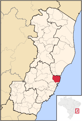
Serra (Espírito Santo)
| Serra | ||
|---|---|---|
|
Coordinates: 20 ° 8 ′ S , 40 ° 18 ′ W Serra on the map of Espírito Santo
|
||
| Basic data | ||
| Country |
|
|
| State |
|
|
| City foundation | November 6, 1556 | |
| Residents | 409,324 (2010) | |
| City insignia | ||
| Detailed data | ||
| surface | 553.254 km² | |
| Population density | 739.85 inhabitants / km 2 | |
| height | 301 m | |
| Time zone | UTC −3 | |
| City Presidency | Audifax (PSB) | |
| Website | ||
Serra is a city in the Brazilian state of Espírito Santo , to the north of its capital Vitória . In 2010 about 409,000 people lived in Serra on 553 km².
sons and daughters of the town
- Lincoln (* 2000), soccer player
Web links
Commons : Serra - collection of images, videos and audio files


