Seulles
| Seulles | ||
|
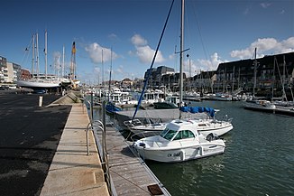
The harbor on the estuary at Courseulles-sur-Mer |
||
| Data | ||
| Water code | FR : I3-0200 | |
| location | France , Normandy region | |
| River system | Seulles | |
| source | in the municipality of Jurques 49 ° 1 ′ 24 ″ N , 0 ° 45 ′ 48 ″ W |
|
| Source height | approx. 230 m | |
| muzzle | in Courseulles-sur-Mer in the English Channel Coordinates: 49 ° 20 ′ 15 ″ N , 0 ° 27 ′ 25 ″ W 49 ° 20 ′ 15 ″ N , 0 ° 27 ′ 25 ″ W |
|
| Mouth height | approx. 0 m | |
| Height difference | approx. 230 m | |
| Bottom slope | approx. 3.2 ‰ | |
| length | 72 km | |
| Right tributaries | Mue , Thue | |
| Navigable | in the mouth area | |
The Seulles is a river in France that runs in the Calvados department in the Normandy region . It rises in the municipal area of Jurques , drains generally in a north-easterly direction and flows into the English Channel after 72 kilometers in Courseulles-sur-Mer . On its way, the Seulles crosses the Pré- Bocage and Bessin landscapes .
Places on the river
- Coulvain
- Anctoville
- Tilly-sur-Seulles
- Esquay-sur-Seulles
- Vienne-en-Bessin
- Creully
- Colombiers-sur-Seulles
- Districts
- Graye-sur-Mer
- Courseulles-sur-Mer
history
After the Allied troops invaded Normandy in World War II (D-Day June 6, 1944) the valley of the Seulles was fiercely contested. See Battle of Tilly-sur-Seulles !
