Colombiers-sur-Seulles
| Colombiers-sur-Seulles | ||
|---|---|---|

|
|
|
| region | Normandy | |
| Department | Calvados | |
| Arrondissement | Bayeux | |
| Canton | Bretteville-l'Orgueilleuse | |
| Community association | Seulles Terre et Mer | |
| Coordinates | 49 ° 18 ′ N , 0 ° 31 ′ W | |
| height | 2-56 m | |
| surface | 3.29 km 2 | |
| Residents | 164 (January 1, 2017) | |
| Population density | 50 inhabitants / km 2 | |
| Post Code | 14480 | |
| INSEE code | 14169 | |
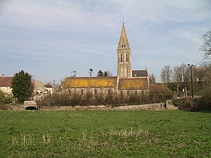
 Saint-Vigor church |
||
Colombiers-sur-Seulles is a French commune with 164 inhabitants (as of January 1, 2017) in the Calvados department in the Normandy region .
geography
The municipality is located 13 kilometers northeast of Bayeux and two kilometers from Creully in the valley of the Seulles .
history
Archaeological investigations revealed several barrows from the end of the 5th millennium BC. Found. The Colombiers-sur-Seulles tumulus is the oldest stone structure in Normandy ; it is now owned by the General Council of the Department. Nearby is the Menhir des Demoiselles or Pierre Debout.
Demographics
Between 1962 and 1999 the population increased by 23.1%.
| year | 1962 | 1968 | 1975 | 1982 | 1990 | 1999 | 2016 |
|---|---|---|---|---|---|---|---|
| Residents | 147 | 164 | 166 | 158 | 160 | 181 | 166 |
Attractions
- Tumulus of Colombiers-sur-Seulles
- Saint Vigor Church (11th century; restored in the 19th century)
Web links
Commons : Colombiers-sur-Seulles - Collection of images, videos and audio files
