Cristot
| Cristot | ||
|---|---|---|
|
|
||
| region | Normandy | |
| Department | Calvados | |
| Arrondissement | Bayeux | |
| Canton | Bretteville-l'Orgueilleuse | |
| Community association | Seulles Terre et Mer | |
| Coordinates | 49 ° 12 ′ N , 0 ° 35 ′ W | |
| height | 66-106 m | |
| surface | 3.92 km 2 | |
| Residents | 214 (January 1, 2017) | |
| Population density | 55 inhabitants / km 2 | |
| Post Code | 14250 | |
| INSEE code | 14205 | |
Cristot is a French municipality with 214 inhabitants (as of January 1 2017) in the department of Calvados in the region of Normandy . It belongs to the Arrondissement of Bayeux and the canton of Bretteville-l'Orgueilleuse .
geography
Cristot is located in the Bessin , 13 kilometers from Bayeux and 16 kilometers from Caen . The community is surrounded by
- Loucelles in the north,
- Thue et Mue with Brouay in the northeast, Le Mesnil-Patry in the east and Cheux in the southeast,
- Fontenay-le-Pesnel in the south,
- Tilly-sur-Seulles in the southwest,
- Bucéels in the west,
- Audrieu in a north-westerly direction.
Population development
| year | 1954 | 1962 | 1968 | 1975 | 1982 | 1990 | 1999 | 2008 |
| Residents | 129 | 162 | 146 | 142 | 133 | 152 | 160 | 214 |
| Source: Cassini, EHESS and INSEE | ||||||||
Attractions
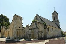
- Saint-André church
- Large country house
- Lavoir
- Former Royal Air Force airfields from World War II , some of which are still visible
Web links
Commons : Cristot - Collection of images, videos and audio files

