
Siegfriedviertel

|
|
| District: | 331 - north town |
| Residents: | approx. 7,500 |
| Height: | 75 m above sea level NN |
| Post Code: | 38106, 38112, 38114 |
 Siegfried Monument on Burgundenplatz |
|
The Siegfriedviertel is a city quarter in Braunschweig that emerged as a settlement from the 1920s. It is located in the Nordstadt district . As a settlement in the countryside and in the modern style, it is now a cultural monument. The name of the quarter and the street names are based on the Nibelung saga about Siegfried the dragon slayer .
history
The Siegfriedviertel stretches in an east-west direction from the Braunschweig – Wieren railway line to Hamburger Straße, and in a north-south direction also from the railway line to the Rebenring. It represents the largest Brunswick settlement project of the interwar period. It was built in two large construction phases on the Ärkeroder field. Ärkeroder field is an old field name that developed from the village name Marquarderoth . This area came into the possession of the city in 1913, but at that time not yet for settlement purposes.
The development took place in a first construction phase from 1926 to 1931, in a second from 1933 to 1941, but mainly in the years 1935 to 1937. The living concept is based on the designs for the Braunschweig “ garden city ” from 1919 by city architect Herman Flesche (1896– 1972), whose designs were based on Theodor Goecke's general urban expansion concept of 1917 and the English garden city of Letchworth . At that time it already contained the horseshoe-shaped shape with the later Siegfriedstrasse as the “backbone”. This concept deviated from the previously common ring-shaped urban expansion of the Braunschweiger Ring . This concept was based on the thoughts of the English garden city planner Raymond Unwin with his "satellite city expansion scheme".
House building began in 1921/22, but with the increasing housing shortage from the mid-1920s, multi-storey residential buildings were increasingly built. The first phase of construction was completed in 1929, and construction work only resumed in 1935 when the second phase of construction began. With this so-called “second labor battle” the expansion of the Siegfriedviertel began on March 21, 1935. In the north-eastern part (Dietrich-, Roland- and Artusstraße) and on the southern edge (Freyastraße) two-storey single-family row houses with a garden part (“own Scholle”) built.
The developers were the Braunschweiger Baugenossenschaft, GAGFAH and Nibelungen Wohnbau GmbH, which was originally founded in 1926 to supervise and later manage the apartments in the Siegfriedviertel. As a further development, a large barracks complex was built east of Bienroder Weg. After its creation, the barracks housed the 31st Infantry Division, which consisted of various intelligence units, and later a unit of the Federal Border Guard . Today the campus north of the TU Braunschweig and partly still the federal police are located on their premises .
Donnerburgsiedlung
With the construction of the Donnerburgsiedlung in the 1930s, the Siegfriedviertel was expanded. It forms the western connection to Hamburger Straße. In 1938/39, Nibelungen Wohnbau GmbH built free-standing houses and two-story row houses as so-called people's apartments.
The name Donnerburg goes back to a magazine building from the 18th century, which was popularly known as that. It was on a hill on which the church of St. George was later built. The parish of St. Georg was supposed to be just a subdistrict of St. Katharinen (1943), but was made independent in 1935. At the time when the settlement was planned, the church and the rectory were already under construction, so that the settlement, unusual for the Nazi era, had to be built around the sacred building. It forms the center of the settlement, but has no market or business area. This function is taken over by the Nibelungenplatz and is therefore the link between the Donnerburgsiedlung and the Siegfriedviertel. As in the Siegfriedviertel, the street names come from the Nibelungen saga.
Valkyrie ring

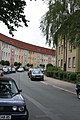
Tram in the Siegfriedviertel

School and community garden north of the Siegfriedviertel

St. George Church

Nibelungenplatz


environment
On the outskirts of the Siegfriedviertel there was a wide range of industrial facilities, such as the canning industry of Schmalbach-Lubeca AG (beverage can manufacturer Ball Packaging Europe since 2003 ), Panther Fahrradwerke AG , the Schimmel piano factory , the municipal slaughterhouse and gas works, a waterworks and the Volkswagen plant in Braunschweig (formerly Vorwerk Braunschweig). Of the industrial companies, however, only Ball and VW are left.
literature
- Rolf-Jürgen Grote, Peter Königsfeld, Elke Schlöder: The findings on external polychromy in the Siegfriedviertel Braunschweig , in: Hans-Herbert Möller (Hrsg.): Restoration of cultural monuments. Examples from the preservation of monuments in Lower Saxony (= reports on preservation of monuments , supplement 2), Lower Saxony State Administration Office - Institute for Monument Preservation , Hameln: Niemeyer, 1989, ISBN 3-87585-152-8 , pp. 183–188
- Sabine Köhne-Finster: The Siegfriedviertel in Braunschweig. A socio-spatial consideration. ISW, Braunschweig 2006, ISSN 1614-7898 .
- Markus Mittmann: Building under National Socialism. Niemeyer, Hameln 2003, ISBN 3-8271-9050-9 .
- Helmut Weihsmann : Building under the swastika. Architecture of doom. Promedia Druck- und Verlagsgesellschaft mbH, Vienna 1998, ISBN 3-85371-113-8 , p. 317.
Web links
- The Siegfriedviertel on braunschweig.de
- Monument Preservation Siegfriedviertel (PDF; 915 kB) at m.braunschweig.de
Individual evidence
- ↑ a b Siegfriedviertel on braunschweig.de
- ↑ Siegfriedviertel today on braunschweig.de
.JPG)
Coordinates: 52 ° 17 ' N , 10 ° 31' E