Sikaram Sar
| Sikaram Sar | ||
|---|---|---|
| height | 4755 m | |
| location |
Lugar , Nangarhar ( Afghanistan ), Kurram Agency ( Pakistan ) |
|
| Mountains | Safēd Kōh | |
| Dominance | 162.8 km → Kuh-e Kokzaro Zaghicha | |
| Notch height | 2295 m ↓ ( 2460 m ) | |
| Coordinates | 34 ° 2 '18 " N , 69 ° 54' 12" E | |
|
|
||
| First ascent | 1878/79 by George Batley Scott | |
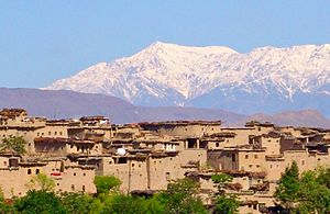
The Mount Sikaram is a mountain on the Pakistani - Afghan border.
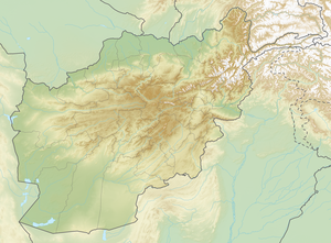
Sikaram Sar is the highest peak of Safēd Kōh with a height of 4755 m . To the west and north are the Afghan provinces of Lugar and Nangarhar . In the southeast is the Kurram Agency , which is one of the tribal areas under the federal administration of Pakistan. The Surkhrud , a right tributary of the Kabul River , drains the northern flank. In the south the Kurram runs in an easterly direction. The Sikaram Sar is located west of the Chaiber Pass and just a little north of the Peiwar Pass .
The first to climb it is the British surveyor George Batley Scott (1844–1932), who climbed the mountain during a campaign to survey Afghanistan in 1878/79.
Web links
- Sikaram Sar on Peakbagger.com (English)
Individual evidence
- ↑ Boleslaw Chwaściński: The Exploration of the Hindu Kush. In: The Alpine Journal. Vol. 71, No. 2 = No. 313, 1966, pp. 199–214, here p. 203, ( digital version (PDF; 6.5 MB) ).

