Silvolde
| province |
|
| local community |
|
|
Area - land - water |
11.98 km 2 11.98 km 2 0 km 2 |
| Residents | 5,385 (Jan 1, 2017) |
| Coordinates | 51 ° 55 ' N , 6 ° 23' E |
| Important traffic route |
|
| prefix | 0315 |
| Postcodes | 5051, 6931, 6952, 7005, 7021, 7054, 7061, 7064-7065, 7071, 7081, 7083 |
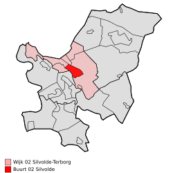
| Location of Silvolde in the municipality of Oude IJsselstreek | |
Silvolde is a village in the Dutch municipality of Oude IJsselstreek ( Achterhoek in the province of Gelderland ). As of January 1, 2017, it has 5,385 inhabitants and borders directly on the small town of Terborg . The Oude IJssel flows south .
The Catholic village, which is called Zillewold during the carnival , is said to have a flourishing club life. A recurring event is the so-called daklozenfeest ("homeless festival "). The Almende College is of supra-local importance : The locatie Isala (Abitur and Fachabitur, havo / vwo) and the locatie Bluemers (secondary school level, vmbo) are located in Silvolde .
History and name
The name Silvolde was first mentioned in 1188. It may come from suli , a Germanic word for a house made up of one room, and wold , ground with bushes. Alternative explanations refer to the nearby IJssel ( Isala ) and wold (forest) flowing by .
When it was first mentioned in 1188, Silvolde belonged to the Archbishopric of Cologne until 1247.
Web links
Individual evidence
- ↑ a b Kerncijfers wijken en buurten 2017 Centraal Bureau voor de Statistiek , accessed on July 20, 2018 (Dutch)


