Sirnitz Pass
| Sirnitz Pass | |||
|---|---|---|---|
|
View from the top of the pass towards Belchen |
|||
| Compass direction | west | east | |
| Pass height | 1079 m above sea level NHN | ||
| state | Baden-Württemberg | ||
| Valley locations | Badenweiler | Neuenweg | |
| expansion | L 131 | ||
| Mountains | Black Forest | ||
| profile | |||
| Max. Incline | 10% | 8th % | |
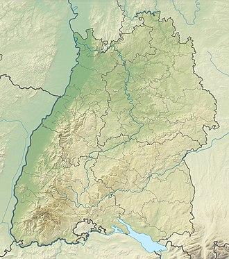
| Map (Baden-Württemberg) | |||
|
|
|||
| Coordinates | 47 ° 48 '1 " N , 7 ° 46' 41" E | ||
The Sirnitz Pass , also known as the Way of the Cross , at 1079 m above sea level. NHN in the southern Black Forest in Baden-Württemberg connects Badenweiler with Neuenweg in the Kleiner Wiesental . After the Hohtannhöhe and the Notschrei, it is the third highest pass in the Lörrach district , with the boundary to the Breisgau-Hochschwarzwald district running near the top of the pass. It is named after the Sirnitz summit, located a few hundred meters to the west in a wooded area with a height of 1114 m above sea level. NHN .
profile
From Badenweiler, the road 131 leads over the Schweighof district and the hamlet of Sirnitz, first mentioned in 1428, in comparatively few switchbacks, mostly along the Klemmbach eastwards to the top of the pass. On the west ramp, a total of 711 meters in altitude over 10.4 kilometers are overcome in nine sharp bends . This corresponds to an average gradient of 6.8%, the maximum gradient of 10% is reached once in the lower and once in the upper third of the pass road.
The top of the pass, on which the district boundary between Lörrach and the Breisgau-Hochschwarzwald runs, is 1079 m above sea level. Reached NHN . There is a parking lot for hikers to the south of the street. In the north rises the 1143 meter high Weiherkopf, to which a ski lift leads up, and the 1224 meter high Köhlgarten south of the pass.
From the Sirnitz Pass, the ramp runs eastwards for 6.6 kilometers in the direction of Neuenweg. The difference in altitude on the east side is 376 meters, which corresponds to an average gradient of 5.7%. The maximum gradient is 8%. There are only two sharp turns on the east ramp. About 3.5 kilometers from the top of the pass, a path branches off to another hiking car park, which is part of the Nonnenmattweiher nature reserve . The east ramp is roughly based on the course of the Kreuzbächle, which later joins the Weiherbach coming from the Nonnenmattweiher.
About 1.9 kilometers below the top of the pass at Hinterheubronn at Haldenhof ( 929 m above sea level ) the road branches off as Landstrasse 130 northwards to the Münstertal / Black Forest . The largely unforested route overcomes 11.9 kilometers of 705 meters in altitude, which corresponds to an average gradient of 5.9%. The maximum gradient of 12% is about half of the route. The pass road ends at the town hall in Münstertal.
history
In the course of the March Revolution in April 1848, the militants from Georg Herwegh's German Democratic Legion, who were involved in the Hecker uprising , climbed the Sirnitz Pass, which was then difficult to reach, in order to evade government troops and fled towards Mulden in the Münstertal .
Nature and natural space
The Sirnitz Pass forms the watershed between the Klemmbach in the west and the catchment area of the Kleiner Wiese in the east.
Traffic routes
In addition to an individual journey to the Sirnitzpass, regular lines of the Südbadenbus and the Südwestdeutsche Landesverkehrs-AG run from Badenweiler and Schopfheim to the pass. Stops are located directly at the pass and at Haldenhof.
The eleventh stage leads over the pass, between Wiedener Eck and the Blauen , of the western route (variant A) of the Westweg . (→ Eleventh stage: Wiedener Eck - Blauen )
literature
- Johannes Helm : The Sirnitz is changing from a Meierhof to an excursion destination. In: Das Markgräflerland , issue 2/1962, pp. 1–16. ( Digitized version of the Freiburg University Library )
- Franz Josef Baer: Chronicle of road construction and road traffic in the Grand Duchy of Baden , published by Julius Springer, Berlin 1878, pp. 223-227. ( here online )
Web links
- Way of the Cross (1080 m). Sirnitz - pass description
- Hiking Kälbelescheuer - Nonnenmattweiher - Description of a circular hike on the Sirnitz Pass
- Regional information system for Baden-Württemberg : "Plan No. 2 on limit regulation on the Sirnitz" - border map from 1840
- Aerial photos of the hamlet of Sirnitz
Individual evidence
- ^ Regional information system for Baden-Württemberg: Sirnitz - Wohnplatz , last accessed on April 26, 2019
- ↑ State Center for Civic Education Baden-Württemberg : Information on the Hecker Uprising (PDF), p. 3, last accessed on April 26, 2019
- ↑ Helm: The Sirnitz in its change from the Meierhof to the excursion destination. P. 1

