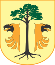
Sośnie
| Sośnie | ||
|---|---|---|

|
|
|
| Basic data | ||
| State : | Poland | |
| Voivodeship : | Greater Poland | |
| Powiat : | Ostrów Wielkopolski | |
| Geographic location : | 51 ° 28 ' N , 17 ° 37' E | |
| Height : | 129 m npm | |
| Residents : | see Gmina | |
| Postal code : | 63-435 | |
| Telephone code : | (+48) 62 | |
| License plate : | POS | |
| Gmina | ||
| Gminatype: | Rural community | |
| Gmina structure: | 17 school authorities | |
| Surface: | 187.46 km² | |
| Residents: | 6573 (Jun. 30, 2019) |
|
| Population density : | 35 inhabitants / km² | |
| Community number ( GUS ): | 3017082 | |
| Administration (as of 2006) | ||
| Community leader : | Michał Wilczura | |
| Address: | ul.Wielkopolska 47 63-435 Sośnie |
|
| Website : | www.sosnie.pl | |
Sośnie ( German Suschen ) is a village and seat of the rural community of the same name in Poland . The place is in the powiat Ostrowski of the Greater Poland Voivodeship . Until 1920, the majority of the community belonged to the district of Groß Wartenberg in Silesia .
local community
The rural community of Sośnie includes 17 districts ( German names until 1945 ) with a Schulzenamt:
|
|
Other localities in the municipality are:
|
|
Web links
- German topographer. Map, 4571 Tscheschen (1: 25000), from 1887
- German topographer. Map, 4471 Uciechow (1: 25000), edition 1 of the XI. 1944
- German topographer. Map, 4571 Tscheschen (1: 25000), edition 1 of the XI. 1940
- Chechen district
Footnotes
- ↑ population. Size and Structure by Territorial Division. As of June 30, 2019. Główny Urząd Statystyczny (GUS) (PDF files; 0.99 MiB), accessed December 24, 2019 .
- ↑ The Genealogical Place Directory
- ↑ a b Tscheschen district - community renaming
- ↑ a b c d German topographer. Map, 4471 Uciechow
- ↑ German topographer. Map, 4571 Tscheschen
