Solnetschny (Chanting and Mansi)
| settlement
Solnechny
Solnechny
|
||||||||||||||||||||||||||||||||||||
|
||||||||||||||||||||||||||||||||||||
|
||||||||||||||||||||||||||||||||||||
| List of large settlements in Russia | ||||||||||||||||||||||||||||||||||||
Solnetschny ( Russian Солнечный ) is a rural settlement in the Autonomous Okrug of Khanty and Mansi / Ugra ( Russia ) with 10,103 inhabitants (as of October 14, 2010).
geography
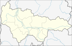
The settlement is located in the central part of the West Siberian lowlands , about 225 km as the crow flies east-northeast of the district administrative center of Khanty-Mansiysk .
Solnetschny belongs to the Rajon Surgut and is located about 12 km west of the center of its administrative seat Surgut . The place itself is the administrative seat of the rural community of the same name (Selskoje posselenije), to which the village Saigatina with a good 1000 inhabitants, about 15 km west not far from the right bank of the Ob , belongs.
history
In place of the current location, there has been a settlement with temporary accommodation for workers who built pipelines in the area since 1975 , named Barsowo-2 after the three kilometers south of the town (from 1979 urban-type settlement ) Barsowo .
In 1980 it was decided to build a prefabricated housing estate. The first buildings were ready for occupancy in 1984, and on May 14, 1985 the place received its current name (Russian for sunny ) and the status of an independent, (rural) settlement (possjolok), which it still has today despite its urban character.
Initially, the settlement was subordinate to the Belojarsky village soviet (based in the urban-type Bely Yar settlement five kilometers south-east ), but was spun off as part of the expansion of the place at the end of the 1990s.
Population development
| year | Residents |
|---|---|
| 2002 | 9,763 |
| 2010 | 10,103 |
Note: census data
economy
Solnetschny is primarily a residential suburb of Surgut with various supply, construction and transport companies.
The regional road that connects Surgut with the city of Ljantor runs past the northeastern outskirts . This branches off the R404 immediately to the east of the village, the most important road connection in the autonomous district, which connects Surgut and the entire area to the right of the Ob with Tyumen and crosses the Ob a few kilometers south with the Surgut Bridge .
Individual evidence
- ↑ a b c Itogi Vserossijskoj perepisi naselenija 2010 goda. Tom 1. Čislennostʹ i razmeščenie naselenija (Results of the All-Russian Census 2010. Volume 1. Number and distribution of the population). Tables 5 , pp. 12-209; 11 , pp. 312–979 (download from the website of the Federal Service for State Statistics of the Russian Federation)
Web links
- Official web portal of the rural community Solnetschny (Russian)
- Rural community Solnetschny on the Rajon administration website (Russian)

