Les Diablerets (mountain)
| Le Sommet des Diablerets | ||
|---|---|---|
|
View from the Sommet des Diablerets to the northeast to the Oldenhorn |
||
| height | 3210 m above sea level M. | |
| location | Cantons of Valais and Vaud , Switzerland | |
| Mountains | Vaudois Alps , Bernese Alps | |
| Dominance | 14.3 km → Wildhorn | |
| Notch height | 958 m ↓ Col du Sanetsch | |
| Coordinates | 580 758 / 128084 | |
|
|
||
| Normal way | L - easy alpine tour (glaciated) | |
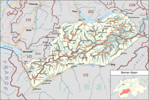
Les Diablerets (German translation: Devil's Horns ; former names: Rochers or Scex de Champ ) refers to a glaciated mountain group of the Vaudois Alps (part of the Bernese Alps ) in Switzerland . The climatic health resort of Les Diablerets , which belongs to the political municipality of Ormont-Dessus , is located at the northern foot of the mountain range .
geography
The border between the cantons of Vaud and Wallis runs along the ridge - in the eastern part the border between Bern and Wallis. The massif is bounded in the south by the Pas de Cheville and the Rhone Valley , in the east by the Sanetsch Pass and in the north by the Col du Pillon .
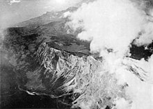
The actual main summit Le Sommet des Diablerets reaches 3210 m above sea level. M. Other summits are the Oldenhorn ( 3123 m above sea level. M. , Fr .: Becca d'Audon ), where the three cantons Vaud, Valais and Bern collide, the Sex Rouge ( 2971 m above sea level. M. ), the Tête Ronde ( 3037 m above sea level ) and the Culan ( 2789 m above sea level ), which forms the western boundary of the massif.
Between the Sommet and the Oldenhorn there is a 2900 m high plateau, from which the Tsanfleuron glacier flows to the east and the Sex Rouge glacier to the northeast. To the north and south, the massif has striking rock faces, especially the southern flank plunges almost vertically, sometimes over 1000 meters into the Derborence valley . The formation of this southern rock face by a landslide on June 23, 1749 with approx. 50 million m³ over 1900 meters in altitude inspired Charles Ferdinand Ramuz to write a novel.
At the Lac de Derborence at the southern foot of the Diablerets were bearded vulture wild.
Development
Since 1964, a cable car has been leading from the Col du Pillon in two sections to the Sex Rouge and enables skiing on the plateau of the Tsanfleuron glacier in the Glacier 3000 ski area. A few years ago, skiing could still be done on the glacier well into summer. In the meantime, due to the dwindling glacier, the ski area is only open between the beginning of November and the beginning of May (as of 2017).
The highest summer toboggan run in the world is operated in summer .
The 107-meter-long Peak Walk is the first suspension bridge in the world to connect two peaks and is open all year round. The SAC's Diableretshütte is located at the Tête aux Chamois middle station of the Glacier 3000 cable car .
Web links
- Official website of the ski area
- Limitation of the Diablerets group on GeoFinder.ch


