Stapelmoorerheide
|
Stapelmoorerheide
City of Weener
|
|
|---|---|
| Coordinates: 53 ° 7 ′ 43 " N , 7 ° 17 ′ 43" E | |
| Height : | 2 m above sea level NN |
| Residents : | 798 (December 31, 2017) |
| Postal code : | 26826 |
|
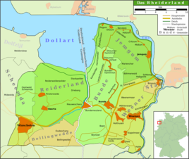
Map of the Rheiderland
|
|
Stapelmoorerheide is a district of the city of Weener in the East Frisian Rheiderland . On December 31, 2017, 798 inhabitants lived in the village. The mayor is Bernhard Siemons.
Stapelmoorerheide is an extension of Stapelmoor. It was created on the high moor bordering on Stapelmoor to the west, which the residents opened up by stretching . The place was first mentioned in 1591 as de Heyde . The name Stapelmohrmer Hayde has been handed down from 1787 . In 1823 there lived in the place 227 inhabitants. 25 years later there were 320 residents in 1848, spread over 56 houses.
Individual evidence
- ↑ Weener.de: Stapelmoor / Stapelmoorerheide , viewed on January 13, 2013.
- ^ Ortschronisten der Ostfriesischen Landschaft: Stapelmoor, Stadt Weener, Landkreis Leer (PDF; 731 kB), accessed on January 15, 2013.

