Vellage
|
Vellage
City of Weener
|
|
|---|---|
| Coordinates: 53 ° 6 ′ 50 ″ N , 7 ° 20 ′ 14 ″ E | |
| Height : | 2 m above sea level NN |
| Residents : | 207 (December 31, 2017) |
| Incorporation : | 1st January 1973 |
| Postal code : | 26826 |
|
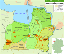
Map of the Rheiderland
|
|
|
Vellager Church
|
|
Vellage is a district of the city of Weener in the East Frisian Rheiderland . 207 inhabitants lived in the village on December 31, 2017. Mayor is Andreas Silze.
Geography and geology
Vellage is around six kilometers from Papenburg on the edge of the Ems glacial valley . The place arose at a bend in the river on the northeast side of a small Geest island made of water-permeable mineral soil ( Gley - Podzol ). He is surrounded by Gleyboden.
history
The presence of people is documented by numerous finds since the Roman Empire . Other relics are dated to the Middle Ages. Vellage was first mentioned as Veldagi around 900 . The name Ueldlagi has been handed down from a register from the 10th century . The place name stands for a "free field area". The place was founded from Aschendorf and was therefore initially under the jurisdiction of the Bishop of Osnabrück. Vellage was later assigned to the Rheiderland.
On January 1, 1973, Vellage was incorporated into the city of Weener.
Attractions
On a mound in the east of the town which lies Vellager church , a brick hall church from the 13th to the late 14th century.
Individual evidence
- ↑ Weener.de: Vellage , accessed on January 13, 2013.
- ↑ a b Ortschronisten der Ostfriesischen Landschaft: Vellage, Stadt Weener, Landkreis Leer (PDF file; 445 kB), accessed on January 14, 2013.
- ^ Federal Statistical Office (ed.): Historical municipality directory for the Federal Republic of Germany. Name, border and key number changes in municipalities, counties and administrative districts from May 27, 1970 to December 31, 1982 . W. Kohlhammer GmbH, Stuttgart / Mainz 1983, ISBN 3-17-003263-1 , p. 263 .


