Beschotenweg
|
Beschotenweg
City of Weener
|
|
|---|---|
| Coordinates: 53 ° 10 ′ 35 " N , 7 ° 17 ′ 34" E | |
| Height : | 1 m above sea level NN |
| Area : | 15.6 km² |
| Residents : | 178 (December 31, 2017) |
| Population density : | 11 inhabitants / km² |
| Incorporation : | 1st January 1973 |
| Postal code : | 26826 |
| Area code : | 04953 |
|
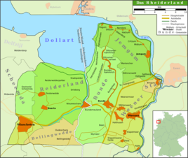
Map of the Rheiderland
|
|
Beschotenweg is a district of the city of Weener . Until its incorporation in 1973, it was the smallest municipality in the Rheiderland in terms of area . In 2017 178 people lived here.
Location and area
The row village is located on a peat bog area about 0.4 square kilometers in size, about two kilometers west of Weener at an altitude between 1.25 and 1.6 m above sea level . Beschotenweg borders directly on the municipality of Bunde . The Weener junction of the A 31 is in the immediate vicinity of the village
history
The Beschotenweg is a medieval road through the high moor between Weener and Bunde. In a document from 1450, the name on Schotenweg appeared for the first time , presumably describing this path. The name is interpreted as a raised, elevated path . Until the middle of the 17th century, the moor was still uninhabited and belonged to the sovereignty of East Frisia . After the transition from East Frisia to Prussia , the first settlers settled here before 1800 and began to clear the high moor. It was then used for agriculture. The community has been independent since the beginning of the 19th century at the latest. At first it belonged to the office, from 1885 to the Weener district . Since its dissolution in 1932, it has belonged to the district of Leer .
On January 1, 1973, Beschotenweg was incorporated into the city of Weener.
Population development
| year | population |
|---|---|
| 1823 | 298 |
| 1848 | 374 |
| 1871 | 361 |
| 1885 | 329 |
| 1905 | 319 |
| 1925 | 292 |
| 1933 | 300 |
| 1946 | 554 |
| 1961 | 276 |
| 1970 | 253 |
| 2001 | 169 |
| 2009 | 181 |
literature
- Village chronicle working group (ed.): Village chronicle Weenermoor - Möhlenwarf - Beschotenweg , Weener, 1993.
Individual evidence
- ↑ a b local chronicles of the East Frisian landscape: Beschotenweg, community Weener, district Leer (PDF; 13 kB).
- ^ Federal Statistical Office (ed.): Historical municipality directory for the Federal Republic of Germany. Name, border and key number changes in municipalities, counties and administrative districts from May 27, 1970 to December 31, 1982 . W. Kohlhammer GmbH, Stuttgart / Mainz 1983, ISBN 3-17-003263-1 , p. 263 .

