Holthuserheide
|
Holthuserheide
City of Weener
|
|
|---|---|
| Coordinates: 53 ° 9 ′ 14 ″ N , 7 ° 18 ′ 8 ″ E | |
| Height : | 2 m above sea level NN |
| Residents : | 396 (December 31, 2017) |
| Postal code : | 26826 |
|
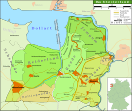
Map of the Rheiderland
|
|
Holthuserheide is a district of the city of Weener in the East Frisian Rheiderland . Almost 400 people lived in the village on December 31, 2017. The mayor is Gerrit Dreesmann.
history
Settlement of the place began at the end of the 19th century on a hitherto undeveloped moorland west of Holthusen . For the first time, the place is recorded under its current name on a map from 1805. It is a combination of the name of the original settlement with heather and is a common name for the region for a new colony on the former communal pasture. The place grew rapidly and in 1848 was already larger than the mother village with 352 inhabitants.
Individual evidence
- ↑ Weener.de: Holthusen / Holthuserheide / Tichelwarf , accessed on January 13, 2013.
- ^ Paul Weßels (local chronicle of the East Frisian landscape): Holthusen, Stadt Weener, district of Leer (PDF; 422 kB), accessed on January 14, 2013.

