Stellberg (Schönbuch)
| Stellberg | ||
|---|---|---|
|
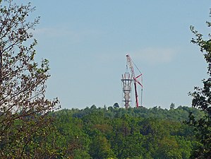
Stellberg from the north, in the evening after the “Big Lift” of the Schönbuchturm |
||
| height | 580.33 m above sea level NN | |
| location | near Herrenberg ; District of Böblingen , Baden-Württemberg ( Germany ) | |
| Mountains | Schönbuch | |
| Coordinates | 48 ° 36 '14 " N , 8 ° 54' 34" E | |
|
|
||
| particularities | - Schönbuchturm , a recultivated, earth-filled former quarry that was used at times as a landfill. | |
The Stellberg is a 580.33 m above sea level. NN high elevation in the west of the Schönbuch . The vantage point is near Herrenberg in the Boeblingen district of Baden-Württemberg .
After filling and recultivation of the quarry , which was previously used as a landfill, the Stellberg is the second highest elevation of the Schönbuch after the Bromberg ( 582.6 m ) and offers a clear view of the Gäu , especially to the west and north . The Schönbuchturm was built on the Stellberg from September 2017 to June 2018 . This 35 meter high observation tower has three platforms and is open to the public.
geography
The Stellberg rises on the western Schönbuchtrauf, in the Herrenberg Forest and in the Schönbuch Nature Park . The high plateau of its artificially created knoll is about 3 km northeast of Herrenberg and about 5 km southwest of Hildrizhausen . To the northeast of the elevation is the Kalte Brunnen, whose water flows through the Kaltenbrunn to the Krebsbach .
The Stellberg belongs to the natural spatial main unit group Swabian Keuper-Lias-Land (No. 10), in the main unit Schönbuch and Glemswald (104) and in the sub-unit Schönbuch (104.1) to the natural area Südlicher Schönbuch (104.12). The Stellberg is located within the landscape protection area (LSG) Schönbuch ( CDDA no. 324243).
history
At the site of the Stellberg there used to be a sandstone quarry, which was used as a landfill from around the 1950s. From the mid-1970s this was filled with earth. Recultivation measures began in the 1990s. At the end of it, stones that could be used as seating were placed on the high plateau, which were arranged in such a way that they are reminiscent of a Stone Age cult site. Landscape conservation measures ensured that the Stellberg could still be used as a vantage point.
Development
Immediately to the south past the former Stellberg quarry leads from Herrenberg to Hildrizhausen on state road 1184. West of the Stellberg, the road crosses the Schönbuch tunnel of federal highway 81 . The Martinusweg and the Black Forest-Swabian Alb-Allgäu-Weg (HW 5) run north and west of the Stellberg .
About 500 meters west of the Stellberg is the Naturfreundehaus of the Herrenberg local group. A little south of it, on the L 1184, lies the Herrenberg forest cemetery. There are parking spaces for hikers there . As part of the construction work for the Schönbuchturm on the Stellberg, an access path was created from there, via which the observation tower can be reached in a few minutes. On both sides of the path there are seven information boards with key words about the tower's characteristics and explanations, as well as a board with facts and figures about the tower.
Individual evidence
- ↑ a b Measurement on behalf of the Böblingen District Office over 5 control measuring points from 2016
- ^ Böblinger Kreiszeitung: Time capsule crowns the Schönbuchturm. 4th May 2018
- ↑ Map services of the Federal Agency for Nature Conservation ( information )
- ↑ Gäubote: Schönbuch tip today: Stellberg viewpoint. January 25, 2012
- ↑ District of Böblingen: Waste Management Concept 2014 (PDF; 7.2 MB)


