Sterzenbach (Kahl)
| Sterzenbach | ||
|
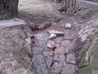
The Sterzenbach at the Sterzenbachweiher |
||
| Data | ||
| location |
Spessart
|
|
| River system | Rhine | |
| Drain over | Kahl → Main → Rhine → North Sea | |
| source | southeast of Hauenstein 50 ° 4 ′ 13 ″ N , 9 ° 11 ′ 56 ″ E |
|
| Source height | 244 m above sea level NHN | |
| muzzle | at the Mensengesäßer Weihern in the Kahl coordinates: 50 ° 3 '45 " N , 9 ° 10' 45" E 50 ° 3 '45 " N , 9 ° 10' 45" E |
|
| Mouth height | 169 m above sea level NHN | |
| Height difference | 75 m | |
| Bottom slope | 42 ‰ | |
| length | 1.8 km | |
| Catchment area | 1.3 km² | |
The Sterzenbach is a right tributary of the Kahl in the district of Aschaffenburg in the Bavarian Spessart .
geography
course
The Sterzenbach rises between Hauenstein and Königshofen . It flows to the southwest as a border stream between the market Mömbris and the municipality of Krombach . At the Mensengesäßer ponds, which are entirely located in the Krombacher area, part of its water is directed into the Sterzenbach pond , built in 1980 . In the further course it crosses under the Kahl – Schöllkrippen railway line and flows into the Kahl opposite the Reichenbach .
Kahl river system
See also
Web links
Commons : Sterzenbach - Collection of images, videos and audio files
Individual evidence

The Sterzenbach flows into the Kahl

