
Stockbach (Südaue)
| Stockbach | ||
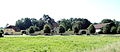
 The Stockbach in Deister above Polenzweg |
||
| Data | ||
| location | Calenberger Land , Hanover region | |
| River system | Weser | |
| Drain over | Südaue → Westaue → Leine → Aller → Weser → North Sea | |
| source | west of the Hohe Warte in the Deister 52 ° 15 ′ 28 ″ N , 9 ° 28 ′ 37 ″ E |
|
| Source height | approx. 330 m | |
| confluence | at Eckerde with the Levester Bach to the Südaue coordinates: 52 ° 19 ′ 30 ″ N , 9 ° 31 ′ 38 ″ E 52 ° 19 ′ 30 ″ N , 9 ° 31 ′ 38 ″ E |
|
| Mouth height | 58 m above sea level NN | |
| Height difference | approx. 272 m | |
| Bottom slope | approx. 25 ‰ | |
| length | approx. 11 km | |
 The Stockbach before crossing Kapellenstrasse in Langreder |
||
The Stockbach is about eleven kilometers long, orographically left or southern spring water of the Südaue in the area of the municipality of Wennigsen and the city of Barsinghausen in the Hanover region in Lower Saxony ( Germany ).
geography
The Stockbach arises to the southwest of the Wennigser district of Wennigser Mark in the Deister, west of the Hohe Warte hill, and flows to the northwest parallel to the ridge path of the Deister. From the west of the parking lot at the top of the Nienstedter Pass to the former scattered settlement Hohe Warte , it forms the border between Wennigsen and the town of Barsinghausen parallel to the road. From here it runs to its mouth only in Barsinghausen area. It flows through the districts of Egestorf and Langreder and joins east of the district of Eckerde with the Levester Bach to form the Südaue . Only the course of the water from the Neue Rehre road in Egestorf falls under the responsibility of the entertainment association 53 over a length of 5.662 km.
history
In the Stockbachtal, hard coal has been mined in several tunnels since the mid-19th century. The buildings of a tunnel on the Hohe Warte, which was closed in 1935, then served as a prisoner-of-war camp, after the World War as a children's home and from 1989 onwards for changing purposes. They have since been torn down and the site is being renatured.
There were several watermills in Egestorf and Langreder on the Stockbach.
Sights and buildings
In Egestorf, the Stockbach passes the Obergut and other architectural monuments in the old village center, as well as the estate there and other architectural monuments in Langreder. See the list of monuments in Barsinghausen .

The Stockbach at the mouth of the Egestorfer tunnel
The Egestorf estate

Watermill at Gut Langreder


_IMG_2788.jpg)
Individual evidence
- ↑ Topographic map (DTK 25) in large enlargement on natur-erleben.niedersachsen.de ( Memento of the original from January 18, 2015 in the Internet Archive ) Info: The archive link was inserted automatically and has not yet been checked. Please check the original and archive link according to the instructions and then remove this notice.
- ↑ List of waters. Entertainment Association West and Südaue, 2014, accessed on January 9, 2015 .