Strada Statale 51 di Alemagna
| Strada statale SS51 in Italy | |

|
|
| map | |
| Basic data | |
| Operator: | ANAS (Veneto) |
| Overall length: | 134,400 km |
|
Regions : |
|
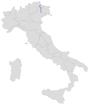
The Strada Statale 51 di Alemagna (abbreviation: SS 51 ) is a 134.440 km long Strade statale (Italian state road) in northern Italy, which leads from San Vendemiano near Conegliano via Cortina d'Ampezzo to Toblach . It is located in the Italian regions of Veneto and South Tyrol .
From Pian di Vedoia (up to there both roads run pretty much next to each other) it is the immediate extension of the A27 Alemagna .
Route
The SS 51 begins at San Vendemiano, in the urban area of the municipality of Conegliano on the SS 13 ( Strada Statale 13 Pontebbana ), and leads via Vittorio Veneto , Ponte nelle Alpi , Longarone to Tai di Cadore . There the SS 51 branches off to the west into the Valle del Boite and leads to Cortina d'Ampezzo. Then it leads north over the Gemärkpass (1518 m) through the Höhlensteintal to Toblach in South Tyrol. There is a connection to the SS 49 Pustertalstraße , which is also the E 66 .
The SS 51 represents an important connection between Venice and South Tyrol and all German-speaking countries. It is assumed that the route has been of great importance since the time of the Roman Empire .
The "Case Cantoniere" (reddish buildings with tool sheds) on the SS 51 were maintenance houses of the Italian road company ANAS , in which "Flicker" lived while they worked on the street.
Others
During the First World War, Austrians and Italians each built a narrow-gauge railway roughly parallel to the SS 51 route. After the Italian Dolomite front collapsed in autumn 1917, the Austrians connected these two to the Dolomite Railway . In 1918 it came into Italian hands. Since June 21, 1921, it has also been transporting people. Traffic ceased in the 1960s; later rails and sleepers were dismantled. Today the Long Path of the Dolomites , a cycle path, runs on approx. 66 km of the former railway line .
Footnotes
