Straky (Zabrušany)
| Straky | ||||
|---|---|---|---|---|
|
||||
| Basic data | ||||
| State : |
|
|||
| Region : | Ústecký kraj | |||
| District : | Teplice | |||
| Municipality : | Zabrušany | |||
| Geographic location : | 50 ° 37 ' N , 13 ° 48' E | |||
| Height: | 260 m nm | |||
| Residents : | 99 (March 1, 2001) | |||
| Postal code : | 417 71 | |||
| License plate : | U | |||
| traffic | ||||
| Street: | Všechlapy - Nová Ves | |||
Straky (German Straka ) is a district of the Czech community Zabrušany in Okres Teplice . It is located one and a half kilometers northeast of Zabrušany in the North Bohemian Basin .
geography
Straky is located on the southern slope of Jalovčiny ( juniper mountains ). The Ve chvojkách ( Juniper Mountain ; 383 m) rises to the northeast . To the west lies the valley of Bouřlivec ( Giant Bach ) with the reservoir Všechlapy, to the southeast, the Tuchlov castle.
Neighboring towns are Řetenice and Teplice in the north, Nová Ves and Prosetice in the Northeast, Kladruby and Pytlíkov the east, Dolánky, Tuchlov, Křemýž and Pňovičky the southeast, Hostomice in the south, Ledvice , Želénky , Zabrušany and Všechlapy in the southwest, Štěrbina the west and Jeníkov and Hudcov in the northwest.
history
Archaeological finds prove an early settlement of the area; A Bronze Age burial ground was found on the southern slope of the Ve chvojkách hill .
The first written mention of the village took place in 1406. At the beginning of the 18th century Straka was added to the Dux rule . At that time the village consisted of eight farmers and one weaver. During the Seven Years' War , the Battle of Hundorf and Kradrob took place north in 1762 . In 1787 there were 14 houses in Straka .
In 1831 Straka consisted of 15 houses with 68 German-speaking residents. The parish was Sobrusan . Until the mid-19th century remained Straka of Fideikommissherrschaft servants Dux.
After the abolition of patrimonial formed Straka / Straky after 1850 a district of the municipality Wschechlab in Leitmeritzer county and judicial district Teplice. From 1868 the village belonged to the Teplitz district and in 1869 was incorporated into Sobrusan together with Wschechlab. In 1900 there were 218 people living in the village. As a result of the Munich Agreement , Straka was added to the German Reich in 1938 and belonged to the Dux district until 1945 . After the end of the Second World War, the place came back to Czechoslovakia and the German-Bohemian population was expelled. After the Okres Duchcov was abolished, Straky was assigned to the Okres Teplice in 1961.
In 1991 Straky had 82 residents. In the 2001 census, 99 people lived in the 32 houses in the village. The place consists of a total of 43 houses.
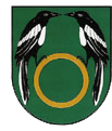
Straky has had a coat of arms since 1997.
Attractions
- chapel
- Ve chvojkách ( Wachholderberg ) with a television tower and a memorial to the peasant liberator Hans Kudlich . The four-meter-high sandstone obelisk was unveiled in 1888 and was layered with 150 stones bearing the names of the villages in the judicial districts of Teplitz, Dux and Bilin.
- Tuchlov Castle, the Empire-style hunting lodge was built by August von Ledebour-Wicheln in 1821
Web links
- Story of Straky (Czech)
Individual evidence
- ↑ Johann Gottfried Sommer : The Kingdom of Bohemia. Represented statistically and topographically. Volume 1: Leitmeritz Circle. Calve, Prague 1833, p. 142.
- ↑ http://www.czso.cz/csu/2009edicniplan.nsf/t/010028D080/$File/13810901.pdf
- ↑ http://www.ukp98.cz/polabi/labe/obce/tp/jalovciny.htm


