Hostomice nad Bílinou
| Hostomice | ||||
|---|---|---|---|---|
|
||||
| Basic data | ||||
| State : |
|
|||
| Region : | Ústecký kraj | |||
| District : | Teplice | |||
| Area : | 299.8136 ha | |||
| Geographic location : | 50 ° 35 ' N , 13 ° 49' E | |||
| Height: | 193 m nm | |||
| Residents : | 1,243 (Jan 1, 2019) | |||
| Postal code : | 417 52 | |||
| License plate : | U | |||
| traffic | ||||
| Railway connection: | Trmice – Bílina | |||
| structure | ||||
| Status: | Městys | |||
| Districts: | 1 | |||
| administration | ||||
| Mayor : | Ivan Holata (as of 2013) | |||
| Address: | Mlýnská 158 417 52 Hostomice nad Bílinou |
|||
| Municipality number: | 567531 | |||
| Website : | www.hostomice.eu | |||
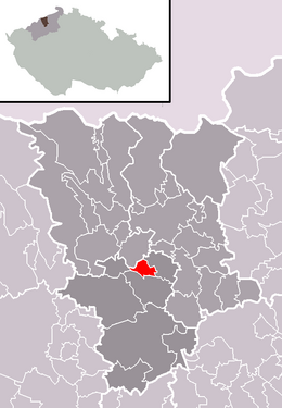
| Location of Hostomice in the Teplice district | ||||

|
||||
Hostomice (German Hostomitz ) is a minority in the Czech Republic . It is located five kilometers northeast of Bílina in the Biela valley on the border between the Ore Mountains and the Hus Hill, the gateway to the Central Bohemian Mountains in the Ústecký kraj .
history
Vratislava, widow of Kojatov , founded the convent of the crucified women in Světec in 1255 and gave it to Hostomice and 14 other villages. In 1438 the inhabitants took part in the Battle of Sellnitz on the side of the Hussites . After the wars there was a new division of property to the Lords of Riesenburg . In 1620 Jan von Vřesovice gave the place to the Archbishop of Prague .
During the industrialization in the 19th century, the rural village changed its face. In addition to glazing and brickworks, lignite was mined here in open-cast mining . Hostomice has been a Městys since 2006 .
Personalities
- Čestmír Císař , politician, former school minister
- Václav Pokorný , former Minister of Energy
- Oldřich Hoblík , actor and director

