Lahošť
| Lahošť | ||||
|---|---|---|---|---|
|
||||
| Basic data | ||||
| State : |
|
|||
| Region : | Ústecký kraj | |||
| District : | Teplice | |||
| Area : | 302,578 ha | |||
| Geographic location : | 50 ° 37 ' N , 13 ° 46' E | |||
| Height: | 213 m nm | |||
| Residents : | 671 (Jan. 1, 2019) | |||
| Postal code : | 417 25 | |||
| License plate : | U | |||
| traffic | ||||
| Street: | Teplice - Duchcov | |||
| Railway connection: | Ústí nad Labem – Chomutov | |||
| structure | ||||
| Status: | local community | |||
| Districts: | 1 | |||
| administration | ||||
| Mayor : | Milan Fábera (as of 2013) | |||
| Address: | Švermova 22 417 25 Lahošť |
|||
| Municipality number: | 567647 | |||
| Website : | www.lahost.cz | |||
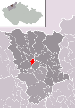
| Location of Lahošť in the Teplice district | ||||

|
||||
Lahošť , until 2006 Lahošt (German Loosch ), is a municipality in the Czech Republic . It is located five kilometers southwest of the city center of Teplice and belongs to the Okres Teplice .
geography
Lahošť is located in the North Bohemian Basin on Bouřlivec (Katzenbach) . The Klášterský potok flows on the southern outskirts and flows into the Bouřlivec west of Lahošť. To the southeast is the Všechlapy reservoir. In the south runs the Ústí nad Labem – Chomutov railway line , on which the Duchcov railway station is located 500 m from the village in the municipality . In the vicinity of Lahošť there are several remaining pits and open-cast pits from the time of lignite mining.
Community structure
No districts are designated for the municipality of Lahošť.
Neighboring places
| Jeníkov (Janegg) | Teplice (Teplitz-Schönau) | |

|
||
| Duchcov (Dux) | Zabrušany (Sobrusan) |
Direct neighbors are Oldřichov u Duchcova in the north, Výšina and Hudcov in the northeast, Nová Ves in the east, Štěrbina , Všechlapy , Zabrušany and Želénky in the southeast, Duchcov in the south, Křínec in the southwest, Nové Sady and Stará Gisela in the west and Jeníkov in the north-west.
history
Lachostze was first mentioned in 1360 as the property of the canons of St. Wenceslas at Prague Castle . In the 14th century, the place became part of the castle rule Riesenburg . In the 15th century the German name Lasch or Laasch was created , which later changed to Loosch . Czech name forms at that time were Lahosst and Lahosstie . After the giant castle was abandoned, Loosch became part of the Dux estate . In 1642 the Counts of Waldstein inherited the rule. In 1680 Johann Friedrich von Waldstein raised the lordships of Dux and Oberleutensdorf to a family affide. The giant spring, a thermal spring with a water temperature of 25 to 38 ° C, was discovered in the 18th century. The Giant Baths ( Křínec ) was built on the road to Dux .
In 1831 Loosch consisted of 53 houses with 213 German-speaking residents. There was a grinder in the village . The Riesenmühle, the Riesenbad, the Radenschänke and the Radenhäusel were set apart. The parish was Janegg . Until the middle of the 19th century Loosch remained subject to the Fideikommissherrschaft Dux.
After the abolition of patrimonial Loosch became part of the market town of Ladowitz in the Leitmeritz district and judicial district of Dux in 1849 . In 1857 Loosch had 230 inhabitants. From 1868 the village belonged to the Teplitz district. From 1880 Loosch formed its own community. Since 1896 the place belonged to the district Dux . From the end of the 19th century, when the German name Loosch dominated, the Czech name Lahošt was introduced around 1880 . Due to the water ingress in the Döllinger colliery in Dux on February 10, 1879, the water level of the giant spring also fell. In 1881 the version of the source was restored. A year later, a bronze treasure from the 3rd – 2nd centuries was found during drilling. Century BC BC, which became famous as the Celtic treasure of Dux and was shown all over Europe.
In 1930 the community of Loosch had 936 inhabitants. Most of the residents were German, and there was also a Czech minority in the village. After the Munich Agreement , it was incorporated into the German Reich in 1938. In 1939, 925 people lived in the municipality in the Dux district . After the Second World War, the German residents were expelled. In 1961 the Okres Duchcov was dissolved and Lahošt was assigned to the Okres Teplice. Because of the lignite mining south of Duchcov, the Ústí nad Labem – Chomutov railway was relocated to the east in 1968 . The city Duchcov lost its railway station, by between Křinec ( Riesenbad scale) and Lahošt station Duchcov was replaced.
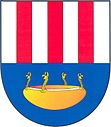
With effect from January 1, 2007, the name of the municipality Lahošt was changed to Lahošť and the Hatschek , which is usually used for similar names, was again included in the place name. Since 2007 the municipality Lahošť has had a coat of arms.
Attractions
- Niche chapel with statue of St. John of Nepomuk on the village square
- 15 m high tower on Obří pramen (giant spring) , built in 1882
- Obří mlýn (Giant Mill)
Sons and daughters of the church
- Johann Lohelius Oehlschlägel (1724–1788), composer
- Alfred Anderle (1925–1994), German Eastern European historian
Web links
Individual evidence
- ↑ http://www.uir.cz/obec/567647/Lahost
- ↑ Český statistický úřad - The population of the Czech municipalities as of January 1, 2019 (PDF; 7.4 MiB)
- ↑ Johann Gottfried Sommer : The Kingdom of Bohemia. Represented statistically and topographically. Volume 1: Leitmeritz Circle. Calve, Prague 1833, p. 142.

