Kladruby u Teplic
| Kladruby | ||||
|---|---|---|---|---|
|
||||
| Basic data | ||||
| State : |
|
|||
| Region : | Ústecký kraj | |||
| District : | Teplice | |||
| Area : | 287.1968 ha | |||
| Geographic location : | 50 ° 37 ' N , 13 ° 50' E | |||
| Height: | 285 m nm | |||
| Residents : | 392 (Jan. 1, 2019) | |||
| Postal code : | 415 01 | |||
| License plate : | U | |||
| traffic | ||||
| Street: | Teplice - Bílina | |||
| structure | ||||
| Status: | local community | |||
| Districts: | 1 | |||
| administration | ||||
| Mayor : | Nicol Pavlů (as of 2018) | |||
| Address: | Kladruby 29 415 01 Teplice 1 |
|||
| Municipality number: | 567604 | |||
| Website : | www.kladrubyuteplic.cz | |||
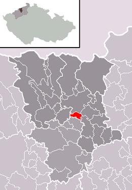
| Location of Kladruby in the Teplice district | ||||

|
||||
Kladruby (German Kradrob ) is a municipality in the Czech Republic . It is located three kilometers south of the city center of Teplice and belongs to the Okres Teplice .
geography
Geographical location
Kladruby is located in the North Bohemian Basin at the southern foot of the Ve Chvojkach ( Juniper Hill ; 383 m) at the source of the Kladrubský potok. To the east and south, the village on the southern outskirts of Teplice is bypassed by the European route 442 / state route 13. Teplice airfield is to the northwest.
Community structure
No districts are shown for the municipality of Kladruby.
Neighboring communities
Neighboring towns are Nová Ves in the north, Prosetice and Bystřany in the north-east, Světice and Úpořiny in the east, Pytlíkov, Lbín, Lysec and Dolánky in the south-east, Ohníč and Křemýž in the south, Pňovičky and Tuchlov in the south-west, Straky and Lahošť in the west and Hudcovš in the north-west .
history
The village was first mentioned in writing in 1370.
The village was dominated by agriculture. During the Seven Years' War , the Battle of Hundorf and Kradrob took place to the northwest in 1762. Kladruby was parish in Teplice. After the abolition of patrimonial Kradrob / Kladrob with the districts Neudörfel / Nová Ves, Webeschan / Vebžany , Ratsch / Hradiště, Welbine / Lbín, Ließnitz / Lysec and Pittling / Pytlíkov formed a municipality in the Töplitz district in 1849. Since the second half of the century, Kladrob and Kladruby were used side by side as Czech place names. In 1890 the village had 371 inhabitants, 346 of whom were Germans and 25 Czechs. There was an estate and a sheep farm in the village. Lignite was extracted on the southwestern periphery. In 1910, the newly created communities Ließnitz with Welbine and Pittling and Webeschan with Ratsch were spun off.
In 1930 the municipality of Kradrob including the district of Neudörfel had 996 inhabitants. After the Munich Agreement , it was incorporated into the German Reich in 1938. In 1939, 838 people lived in the municipality in the Teplitz-Schönau district . After the end of the Second World War, the German population was expelled. In 1961, Nová Ves was reassigned to the town of Teplice.
Culture and sights
- Statue of St. John of Nepomuk
- chapel
- Ve Chvojkach ( Wachholderberg ) with TV tower and monument to the peasant liberator Hans Kudlich
- Tuchlov Castle, the Empire-style hunting lodge was built by August von Ledebour-Wicheln in 1821

