Měrunice
| Měrunice | ||||
|---|---|---|---|---|
|
||||
| Basic data | ||||
| State : |
|
|||
| Region : | Ústecký kraj | |||
| District : | Teplice | |||
| Area : | 1148.5527 ha | |||
| Geographic location : | 50 ° 29 ' N , 13 ° 49' E | |||
| Height: | 425 m nm | |||
| Residents : | 303 (Jan. 1, 2019) | |||
| Postal code : | 417 56 | |||
| License plate : | U | |||
| traffic | ||||
| Street: | Želkovice - Hrobčice | |||
| structure | ||||
| Status: | local community | |||
| Districts: | 2 | |||
| administration | ||||
| Mayor : | Jitka Nová (as of 2013) | |||
| Address: | Měrunice 67 418 04 Bílina 4 |
|||
| Municipality number: | 567698 | |||
| Website : | www.merunice.cz | |||
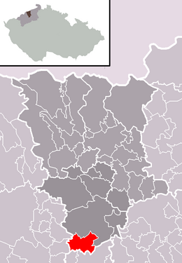
| Location of Měrunice in the Teplice district | ||||

|
||||
Měrunice (German Meronitz ) is a municipality in the Czech Republic . It is located eight kilometers south of Bílina and belongs to the Okres Teplice .
geography
Měrunice is located in the western part of the Bohemian Central Uplands at Lužický potok. To the northeast rise the Hradišťany (752 m) and the Ostrý (718 m). To the east are the Plešivec (509 m) and Hradišťko (536 m); south of the Vraník (483 m).
Neighboring towns are Mrzlice and Mukov in the north, Červený Újezd in the northeast, Leská and Řisuty in the east, Lahovice and Všechlapy in the southeast, Libčeves and Hořenec in the south, Kozly and Chrámce in the southwest, Žichov in the west and Mirošovice and Tvrdín in the northwest.
history
Měrunice was first mentioned as one of the Benedictine convent of John the Baptist founded by Judith von Thuringia around 1165 in Teplice . The first documentary evidence of the village dates from 1295, when the fortress in the village was the seat of Vladiken Jan von Měrunice. At the beginning of the 14th century the village was divided. One part belonged to the Skalka castle , another from 1300 Lipold and Frycek von Moravěves. The third part with the fortress was owned by Bavor from Měrunice. The Vchyňský later acquired the share of the Lords of Moravěves . In 1380 Martin Vchyňský and the brothers Ryker, Peter and Eberhard von Skalka owned the place. With the acquisition of Skalka Castle by Erhart von Sulewicz , the Kaplirz de Sulewicz took over the Skalker share from 1415. The Vchyňský sold their part to Děpolt Popel von Lobkowicz at the beginning of the 16th century . The estate of the Lords of Měrunice passed to the town of Louny . Because of the participation in the anti-Habsburg uprising, in 1547 all of the town's goods fell to the Bohemian Crown, and the boogers from Lobkowicz acquired this share from Měrunice. In the course of the 16th century the whole village passed to the lords of Lobkowicz on Bilin.
After the abolition of patrimonial Meronitz formed with the district Schichhof in 1850 a municipality in the district of Teplitz. Around 1900 the parish came to the Duchcov district and in the 1930s to the Bilin district. At the beginning of the 20th century, the district of Schichhof gained its independence. The inhabitants of Meronitz lived primarily from fruit growing. Maximilian's grenade pit had been located on Wranekberg since the 19th century, where Bohemian garnet was mined. At the time of the garnet mining, the population reached almost a thousand. In 1870 the Church of St. Stanislav was elevated to a parish church.
In 1930 there were 447 inhabitants in Meronitz. Most of the residents were German, and there was also a Czech minority in the village. After the Munich Agreement , it was incorporated into the German Reich in 1938. In 1939, after the Czechs were resettled, 403 people lived in the municipality in the Bilin district . After the Second World War, the German population was expelled and the Czechs settled. In the course of the dissolution of Okres Bílina, Měrunice came to Okres Teplice in 1961. At the same time Žichov was incorporated.
In 2004 a parish partnership was concluded with Beuren, the birthplace of the poet Karl Eckardt, who had worked as a pastor in Meronitz until his death in 1926. On the occasion of the 80th anniversary of Eckardt's death, a German-Czech meeting took place in Měrunice in 2006.
Community structure
The community Měrunice consists of the districts and cadastral districts Měrunice (Meronitz) and Žichov ( Schichow , formerly Schichhof ).
Partner communities
- Beuren , Germany, 2004
Attractions
- Church of St. Stanislav, traceable since 1386
- former festivals
Personalities
- Karl Eckardt (1874–1926), pastor and writer

