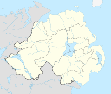
Strangford Lough
Coordinates: 54 ° 29 ′ 0 ″ N , 5 ° 35 ′ 0 ″ W.
The Strangford Lough ( Irish : Loch Cuan ), southeast of Belfast in County Down in Northern Ireland located, is one of the Irish Sea by the Ards Peninsula to the narrow strait between the villages of Portaferry and Strangford detached 18,647-hectare natural harbor. It is 26 kilometers long and about 6 kilometers wide. A third of the lake with its 365 islands near the shore is so shallow that it falls dry when the water is low. The lake is classified as an Area of Outstanding Natural Beauty . The largest city on the shore of the lake is Newtownards . The North Strangford Lough nature reserve is in close proximity .
The highest point on the lake is Scrabo Hill near Newtownards. From above you can see Belfast to the west, the Morne Mountains to the south and south-east over the Lough, the Ards Peninsula and the Isle of Man . A late Bronze Age - Iron Age council was located on the top of the hill, which had been inhabited since the Neolithic.
Of particular scientific interest are the archaeological sites around the lake, including around 50 mesolithic ones . 28 Køkkenmøddinger ( English : midden ) consist mainly of local oysters . Larger concentrations are found at Ardmillan Bay, on Mahee Island and Rough Island , as well as at Castle Espie, on Chapel Island . In front of the island, a stone fish fence was discovered by aerial archeology . Rough Island lies between Comber and Newtownards and is a drumlin, a landscape formed by the Ice Age, accessible on foot during low tide . Several trenches, several flint artifacts and two fireplaces have been discovered from the Mesolithic period ; one within a Køkkenmøddinger. An excavation in 1997 revealed a dark layer of sand with fragments of medieval pottery.
In the tidal area of Chapel Island, stone structures up to 300 meters long were recorded, which are interpreted as fish traps from the nearby Cistercian monastery .
SeaGen tidal power plant

Since April 2008, a tidal power plant called SeaGen (output 1.2 megawatts) has been running in the strait that connects Strangford Lough with the open sea , consisting of a tower standing in the water to which two large rotors are attached, which are driven by the tidal currents are driven.
literature
- Sinéad McCartan: Prehistory. In: Thomas McErlean, Rosemary McConkey, Wes Forsythe: Strangford Lough. An archaeological survey of the maritime cultural landscape (= Northern Ireland Archaeological Monographs. 6). Blackstaff Press et al., Belfast 2002, ISBN 0-85640-723-2 , pp. 41-57.
Web links
- Official website (English)
- Strangford Lough in Northern Ireland Environment Agency (English)


